After hiking across the Sierra from Hatch Hetchy, I ended up at the Buckeye Hot Springs. Just in time for snow to begin to fall on the mountains above. I walked along the road, and almost got to Bridgeport before someone finally picked me up. I had a big burrito, resupplied and checked in with a few friends while debating my next move. My original plan had been to finish a small section of the Yosemite High Route from Virginia Lakes. As the nights got colder and colder, I waffled on this plan. Perhaps I would go down to Bishop, see some friends or hang out at another hot springs for a bit. I had already hiked the AT this summer, and was feeling satisfied with the miles under my feet.
After some back and forth I decided to go for it. I resupplied right as the store was about to close and got to the ranger station with thirty minutes to spare. I thought I could get a permit there for free like the olden days, but they requested I visit apply for a permit on my smartphone and pay Booze Allen Hamilton a cut. Why I had to pay Booze Allen Hamilton $6, when the rangers could have easily written me a permit was beyond me. In the Humboldt Toiyabe National Forest, Booze Allen Hamilton’s cut ($6) actually exceeds the recreation fee ($3). recreation.gov and its associated fees should be enough to dissuade any US American away from any confidence that our elected officials are making even semi competent decisions.
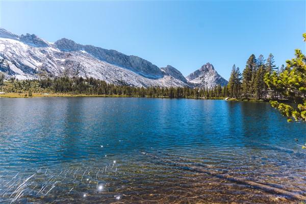
After paying my tax to our corporate overlords, I walked out towards the highway and started hitching south. After my terrible luck earlier in the day, I was rewarded by the hitching gods with two quick rides up to Virginia Lakes. I hiked a few miles up the trail to a lake below Dunderberg Peak and prepared for the cold night ahead. I found an established site in a small grove of white bark pines right at the treeline. After a few hours, the temperature continued to drop, and a fierce wind blew my measly tarp down repeatedly. After many attempts to repitch it, I finally resigned myself to cowboy camping. At some point in my battle with my tent, one of the stakes had been flung so far that I could not find it.
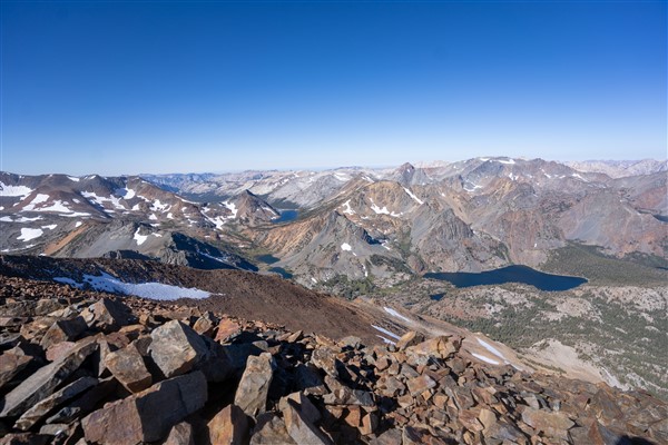
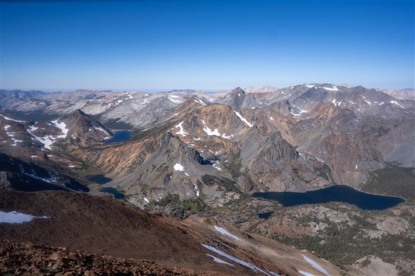
The next morning, I searched for half an hour to try to find the missing stake, but eventually I gave up, left most of my gear, and began to make my way towards the peak. A few hours on loose class II scree and I was on top of Dunderberg. I was treated to a panoramic view of the northern part of the range. I made my way back to my tent, and took one more look around for my stake, before continuing on towards Excelsior Peak.
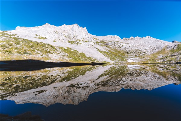
I got into a great groove and made good time on Excelsior Peak as well. Soon I was crossing the Sierra crest and back on the Yosemite High Route. A long climb through a wooded slope, was followed by an hour contouring across a wooded slope and then a few final steps on rock hard ice which brought me within view of Conness at last. I had only ever seen Conness up close from the east, and admired its precipitous west face for the first time. I enjoyed a beautiful sunset, as the last rays of light danced higher and higher on Conness’ imposing west face. Tomorrow I would head for the summit, but via a much easier route.
Night once again swept across the range, the long cold night of fall, warning of the impending winter. The sun rose and I was finally warm enough to sleep for another hour. Somehow when the nights are long, they trap you in a frozen trance and lull you into sleeping into the day. The later start was no matter though, I didn’t have much ground to cover today. I took a long winding route up and around the back of Conness and walked the east ridge to the summit. I had been a bit weary of the east ridge after experiencing other third class ridges in the range. However, the trivial nature of this route shows the wide breath of the third class rating in the Sierra Nevada.
As I stared down the precipitous west face, I met a few climbers that had just climbed that route. For some reason most of the climbers nearly summit the peak from the east and then descend all the way down climb up the west ridge. A rather circuitous way to climb the peak for sure, but I suppose I had arrived at the summit in a strange manner as well. My descent route would be straightforward, save for a few short climbs all downhill to Tuolomne Meadows.
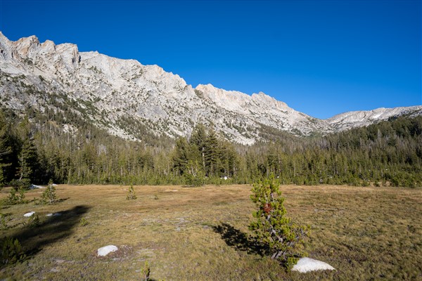
The descent went quickly and before I knew it, I was galloping through those beautiful meadows, in site of the road. I stuck out my thumb and quickly got a ride all the way out to Mammoth Lakes. I grabbed some fresh food in the grocery store, happy to be back amongst the aisles of cheap food at a grocery outlet for the first time in a week. I had told my friend Abe I would go out and visit him, but he was camped seven or eight miles out of Town. He offered to pick me up, but I didn’t want to be a nuisance, I know he preferred to leave the backcountry as little as possible. As problems often do when I am traveling in this style, the problem solved itself. A PCT hiker yelled over “hey do you want any cheesy bread”, “hell yeah, thank you I replied”. Like many other hikers this year, she had flipped around the Sierra to avoid the historic snowpack, and was now back to finish up her hike. She explained some tourists had been on a diet and could only eat half of their chest bread so they had given the rest to her. The hot food tasted incredible after the prior cold nights. Better yet though, she explained a trail angel would be meeting her and some other hikers to drive them out to the Syphon Hot Springs, east of Town. I tagged along and got a ride to within half a mile of where Abe was camping, I trotted down the rough boulder strewn dirt road, unable to wipe the huge grin off my face from how the evening had unfolded. I camped with Abe that night, he cooked me some delicious lentils, and I enjoyed the warm air back down at only 8,000 feet.