The Great Western Divide Traverse was to be our flagship trip of the Summer. I took a whole week off work for the first time since Christmas. Noe and Bridget planned and researched the trip meticulously. We all packed six days of food. Noe and Bridget created a food alliance, whereas I went my own way. Carlos tentatively planned to meet us out there, but we were unsure if this would actually happen.
Day 1
On the first morning we woke up at 5am, and planned to get on the road by 5:30. Noe saw a mouse in the kitchen, so we spent some time “locking down” the house. Once the house was locked down, we got on the road and headed to Onion Valley.
Our packs were heavy from 6 days of food. On our way up the trail we saw a prominent leader in the Paiute community, and she gave us the traditional Paiute greeting “manahuu” as we passed. At the pass we met a few Sierra Challenge participants who had not opted for the 33 miles Clarence King, and were heading back to their cars.

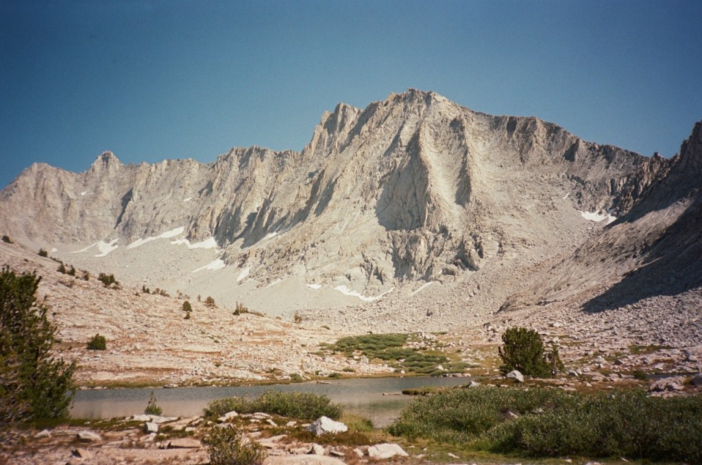
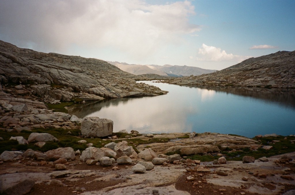
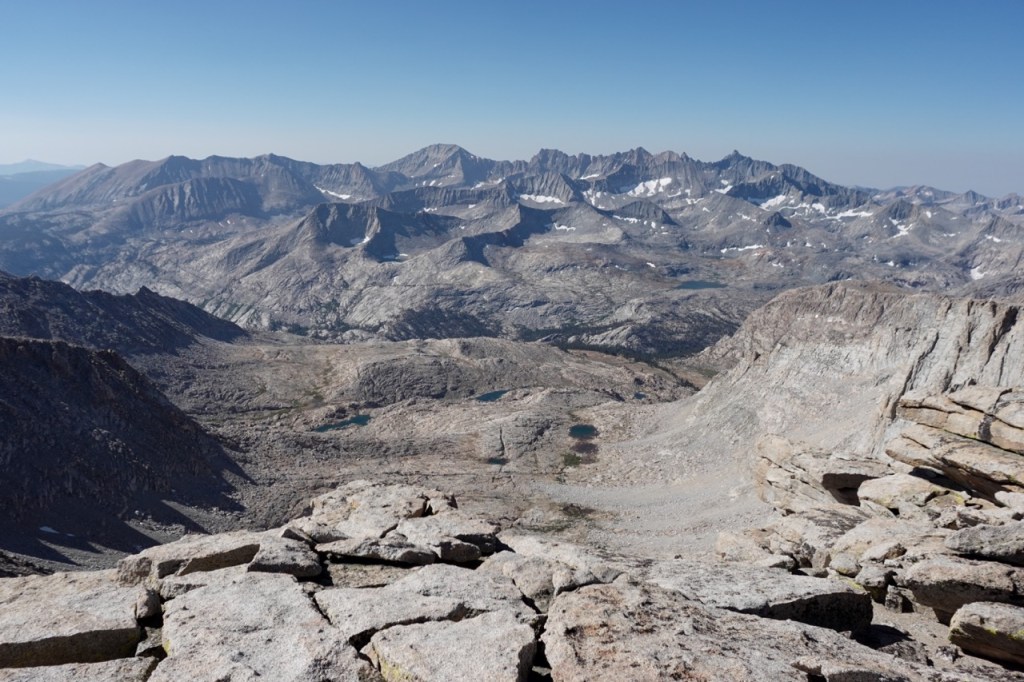
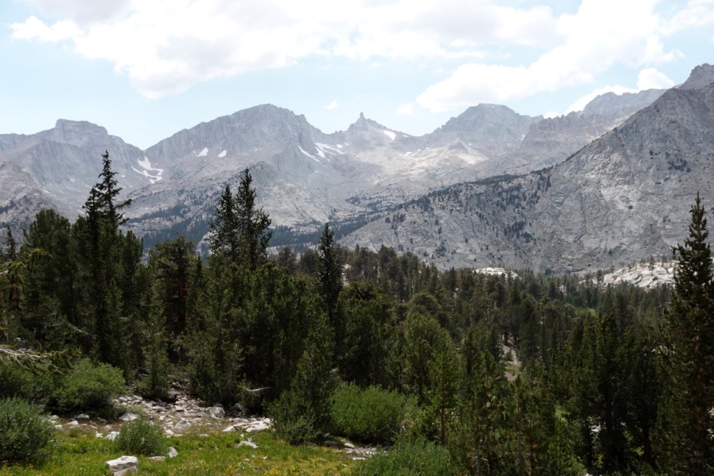
We began the long descent towards Sphinx Creek. We could see Brewer and its Guards, so close but days away. Noe and I had a very interesting conversation about a potential ARC Storm in California: a large flood that could push the state to its limit. This soaked up two hours or so of time. I took a nice bath in Bubbs Creek, and then we began the steep climb up towards Avalanche Pass. This is a masterful piece of trail work. Steps must have been blasted into the granite face. I am always suprised to not see any people on this beautiful trail. In Yosemite, a trail like this would be crawling with tourists.
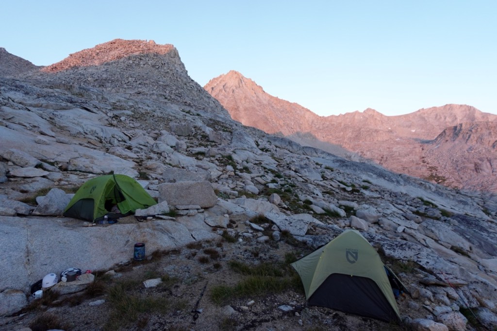
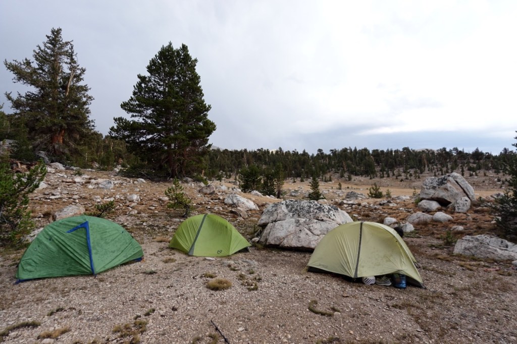
The three of us were all exhausted from the long day with heavy packs, and the days leading up to it. I had hiked Cathedral at night two days prior and was still recovering from the loss of a night of sleep. Bridget had worked as a porter for some wealthy clients the week prior, and Noe too had been quite busy with some adventure or another. We gave ourselves mercy and setup camp where we planned to leave trail. The mosquitoes were abuzz in the meadow, and I was sure glad I had my tent.
Day 2
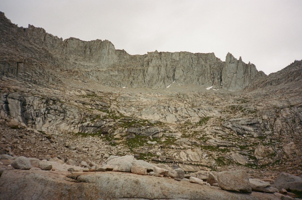
We bid the trees and trail farewell that morning and ventured up into the high country. It was a sluggish start to the day, as our heavy packs felt like they were dragging us down the mountain. Luckily we were able to leave our loads at the base of Francis Farquhar and climb unburdened. Farquhar is not an SPS peak, but Bridget had been seeing it in her dreams. Bridget had no interest in the SPS peaks, but felt a magnetic attraction to the obscure peak.
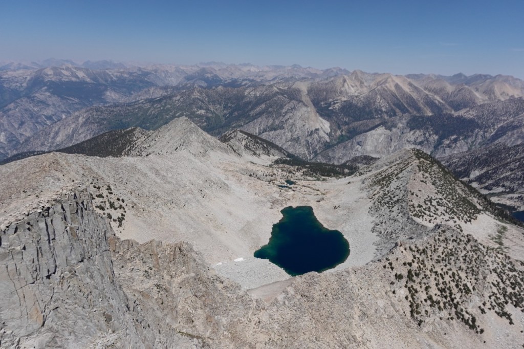
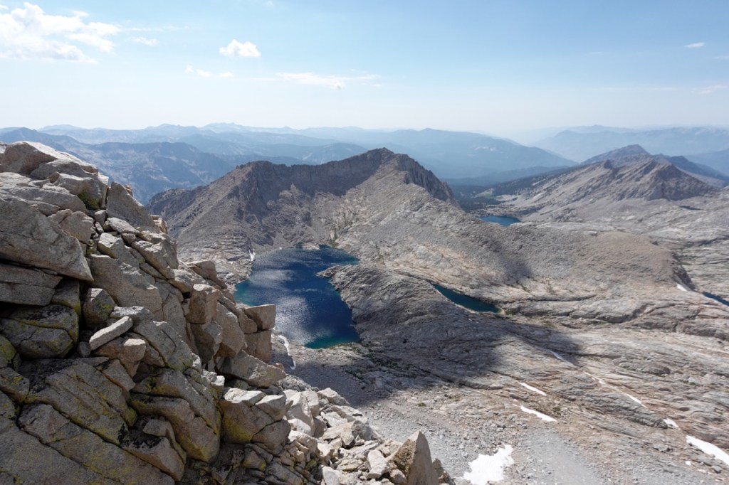
We followed a beautiful chute of solid granite, which took us almost to the top. We all tapped the potato chip like summitblock, but none of us dared mount it. From the top, we had excellent views north back across Bubbs Creek, and great views of our next few days south towards the divide.


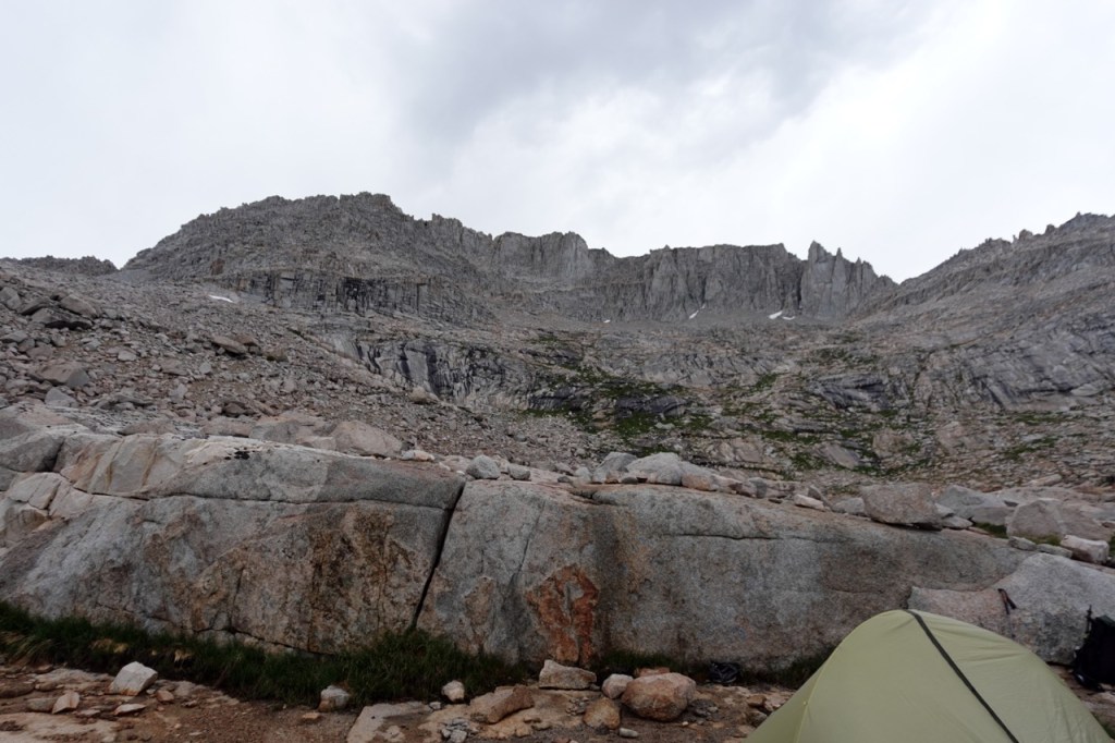
We were all pretty spent, but we only had a few miles left to go now until a beautiful campspot next to North Guard and Brewer. We watched the sunset, and reviewed the beta. The next two days looked tantalizingly easy. 3 and 5 miles. But of course, in reality mileage is only part of the equation in this part of the world.

Day 3
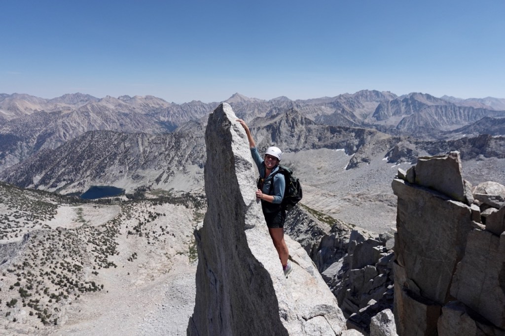
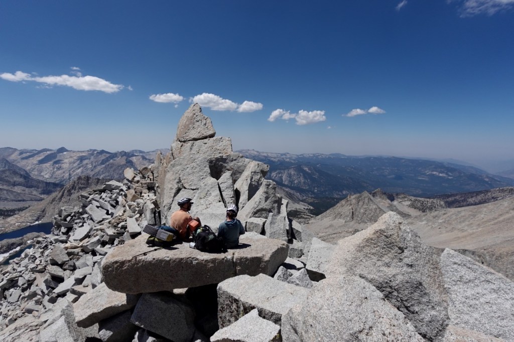
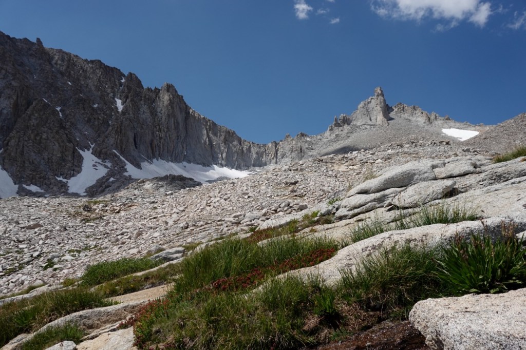
We were up early the next morning to attempt North Guard, one of the two class four peaks on the trip. The route had some fun but trivial scrambling to reach the summit area. Soon, we were greeted by the imposing summitblock, that seems to sit precipitously over a large abyss. Any fall would send one careening down to a quick death. Luckily the holds were exceptional. My heart was racing a bit, but the summitblock felt suprisingly secure. We took turns dangling over the abyss, and took in the stunning views afforded to us by this remote perch.


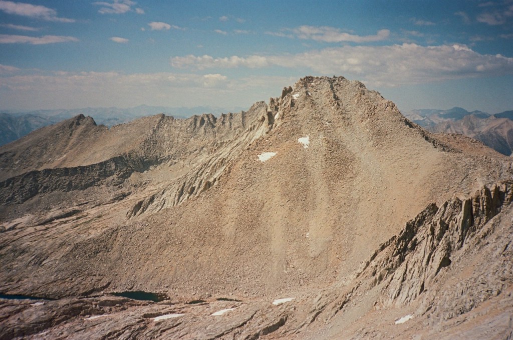
Next we set out for Mt. Brewer. I had climbed this peak three years prior, but was excited to hike it again. We made quick work of the scree slog, and took a lunch break atop the summit. The summitblock felt much easier this time around. In the summit registed we found that Kim G. had dayhiked all three of these peaks from Onion Valley a few days prior. Insane.We descended the south face. Slow scree at the top gave way to loose scree at the botton, and soon we were running down the slope hooting and hollering. I took a nice swim in the lake down there and cooled off a little.
We had one more climb of the day up to South Guard. We were tired from the first two peaks but we trudged on up the pass. The going got very loose, but luckily we spread out quite a bit. I took the far left, Noe took the center, and Bridget the far right. Noe sent some huge rocks down the chute, but it didn’t matter as we were out of the way. We found ourselves on the wide summit plateu and it was a nice easy walk to the summit proper. We marveled at Brewer towering to our north, and started scheming for Thunder the next day.

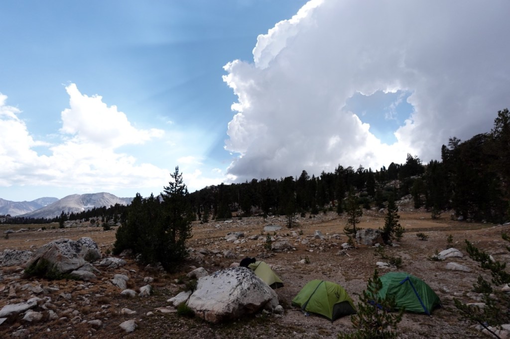
Soon we were in camp. It was only 4pm but we were all exhausted. I suggested pushing on, as it was still early, and the forecast did not look great for the next day. We sent out a few inreach messages, and the prognosis was not great. Thunderstorms were possible in the afternoon. This was not ideal, as we planned to hike two more peaks tomorrow.
Another wildcard was that our friend Carlos planned to meet us on day 4. We had not heard from him, and had all but written him out, but we got a message from him saying he would meet us tomorrow. With all of this new information, we took one final vote on what to do. I again voted to push on, but I was out voted by Noe and Bridget. We decided to meet Carlos atop Thunder Pass at 8am, and keep camp where it was for the night. Together we watched a beautiful sunset on the King Kern Divide.

Day 4
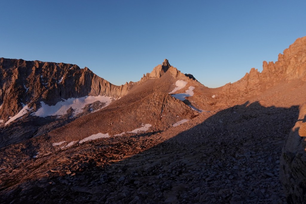
Day 4 began exactly as planned. We got up at 4:45am. By first light at 5:30, we were making our way towards Thunder Pass. I got a bit ahead of Bridget and Noe, which ended up working out in our favor. Thunder Pass was exceptionally loose. Half the holds I grabbed tumbled well down below. Rocks were sliding below me left and right. I was relieved to be well ahead of Noe and Bridget, and tried to move quickly so that I topped out before they moved beneath me. I saw Carlos on the ridge, and I made quick work of the last few hundred feet.
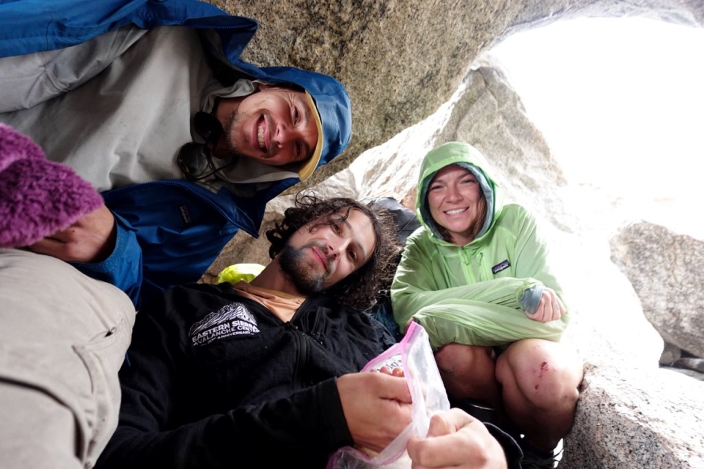
Carlos was the only person we had seen since day 1. I gave him a huge hug and we filled eachother in on the last few days. He had completed the Tuolumne Triple two days prior, and had hiked in over Shepherd Pass yesterday. It was great to see him way out here in the wilderness. Soon Noe and Bridget caught up. They also had a hairy experience on Shepherd Pass. At one point one of them knocked 10 giant boulders down. Sketchy, sketchy. I am glad we were going up instead of down.
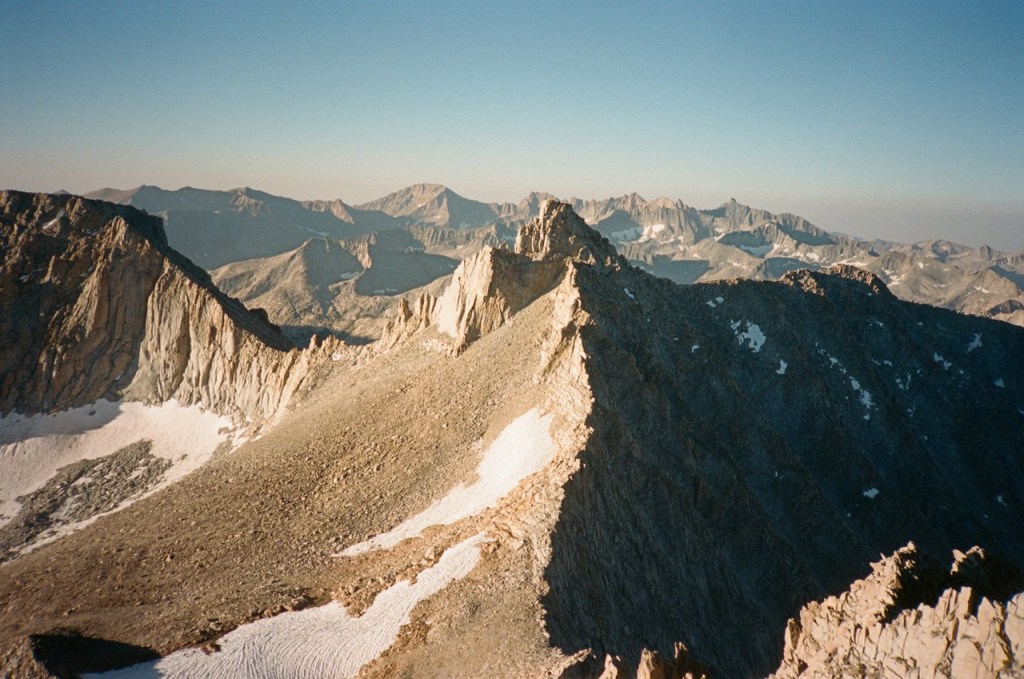
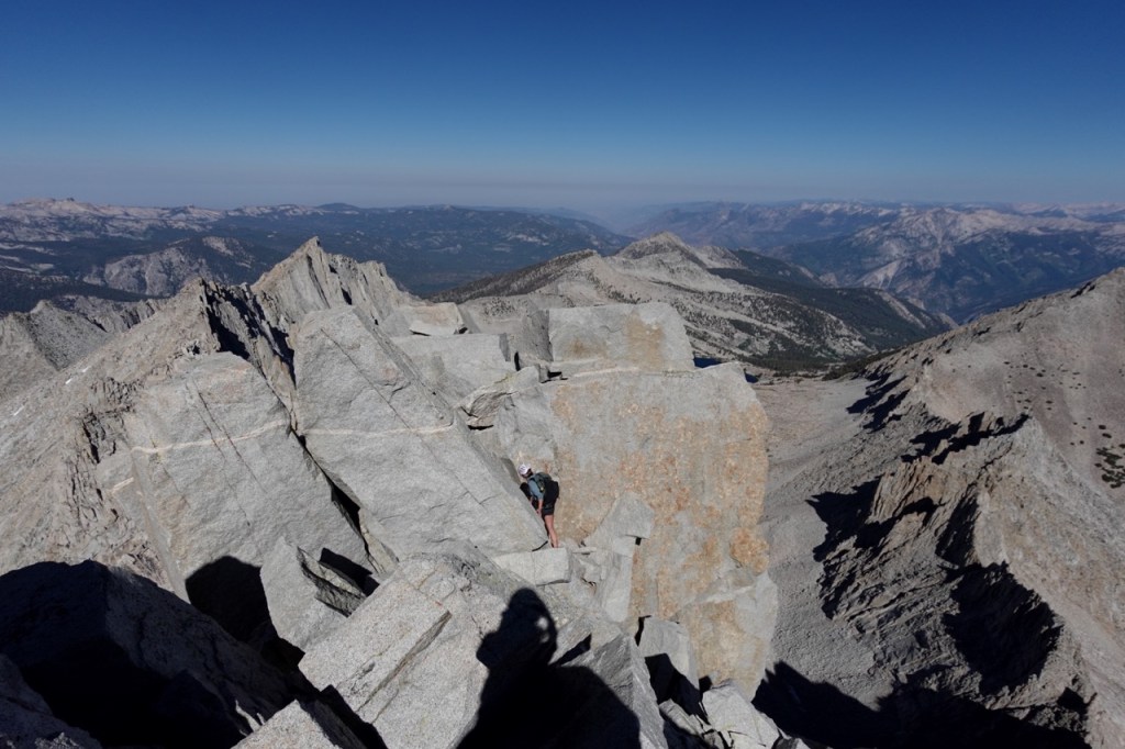
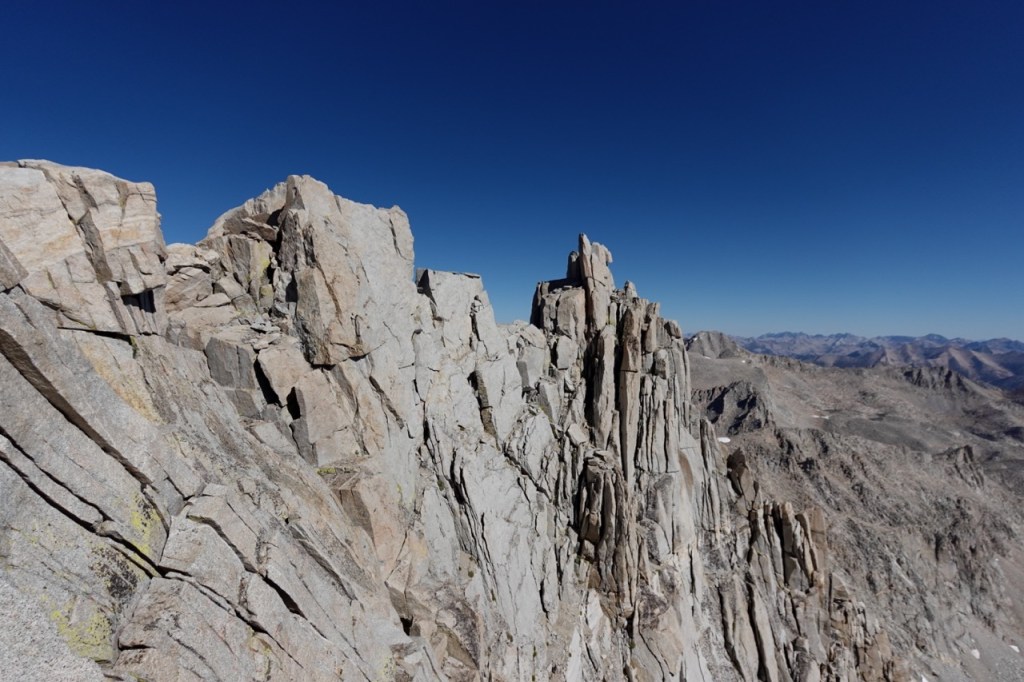
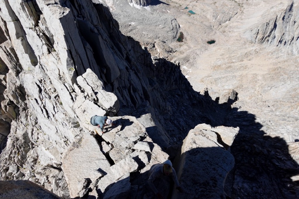
The going became easier until the very top of Thunder Mountain. The final traverse to the summit block involved a lot of class 3/4, but we worked through it together as a team. The summitblock itself involved a choice between two cracks. I climbed boldly up the thinner crack, knowing I would have paused to think about it more if I was up here alone. Worst case, I figured, if I can’t get down on my own, my friends can give me a hand or foot. We sat on the summit momentarily and then headed down quickly. Carlos coached me through the wider crack, and eventually I made it down unassisted. We reversed all of our moves on the traverse without too much trouble and soon we were all back to the safety of class 2.

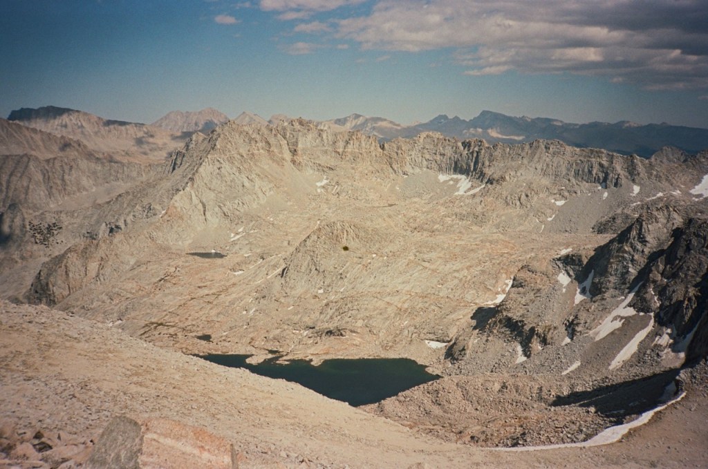
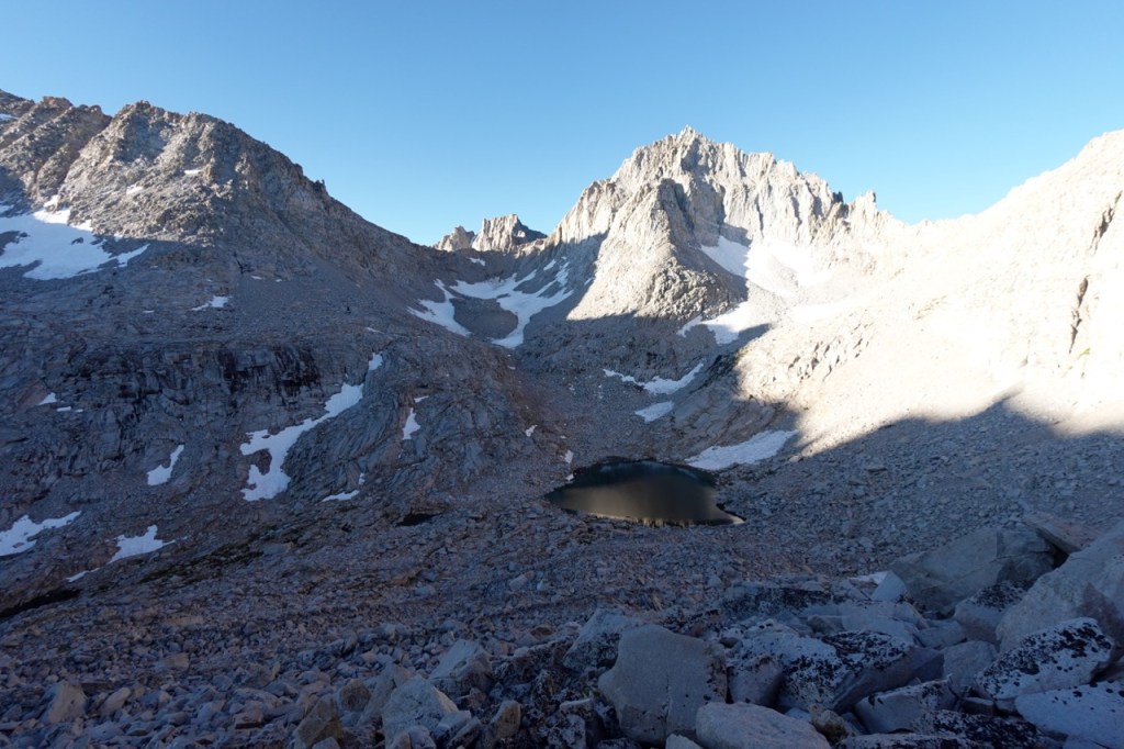
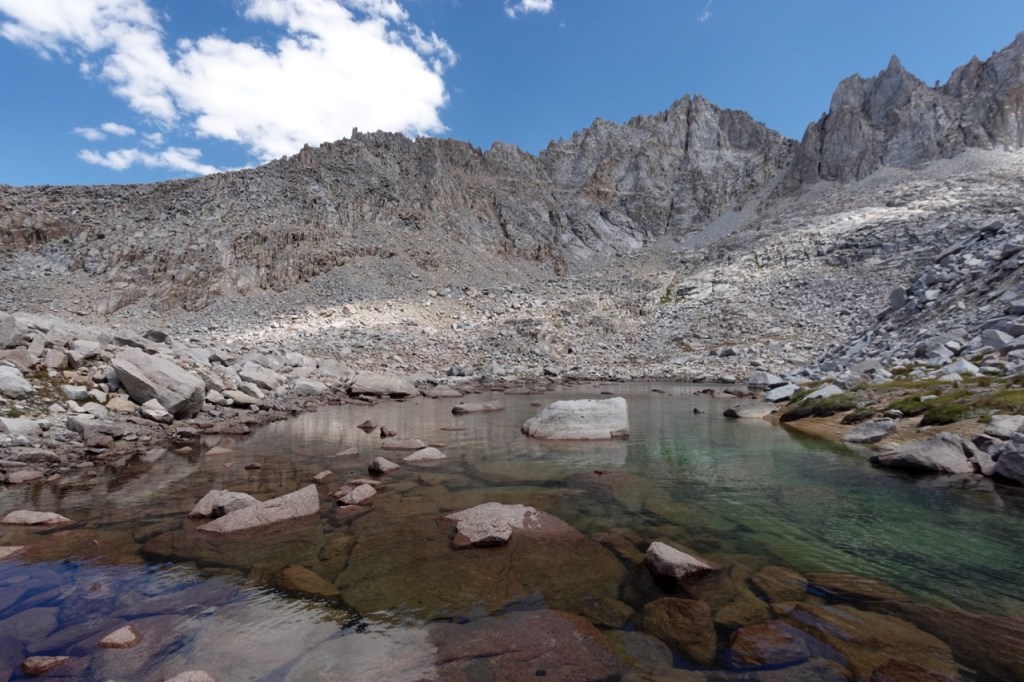
The pass down the other side was pretty loose, but luckily nothing like Thunder Pass. We spread out nonetheless to be on the safe side. At the base of the chute, I got to swim in a tarn with a great view looking back to Thunder Mountain.

The forecaster mentioned the clouds were coming in, so as soon as we were all at the lake we marched onwards, making a giant U around Table mountain, and back up the other side. We contoured around a bit and then began climbing steeply up a chute.
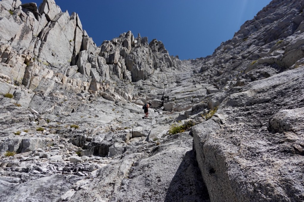
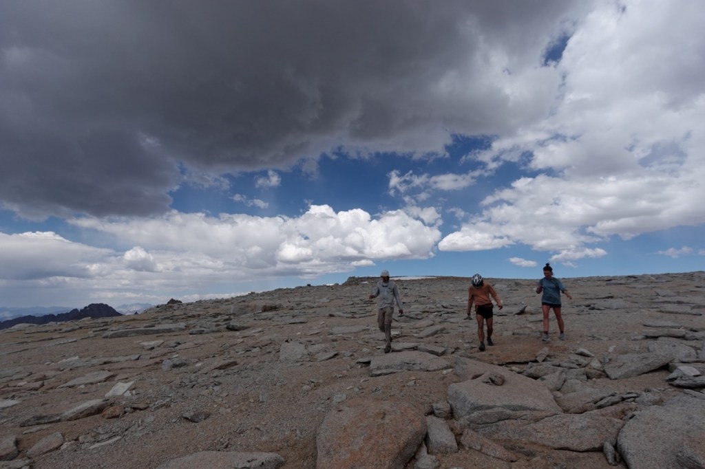
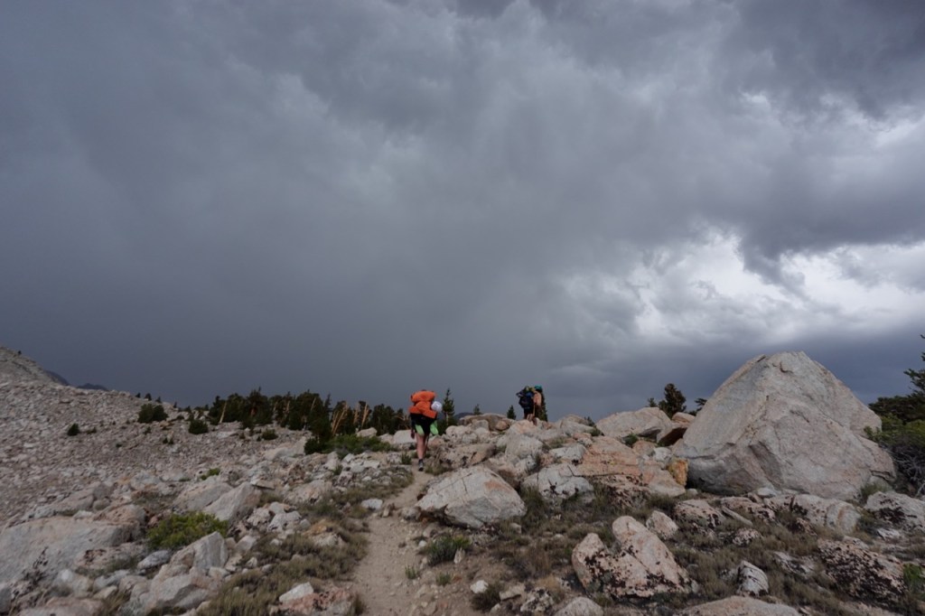
Midway up the chute we reached a decision point. As we consulted beta, Noe gently brought up the topic of the approaching clouds to the group. I made my opinion known that I was not too worried, and Noe pushed back. Obviously in hundsight, Noe was right to be concerned. Noe mentioned the possibility of sheltering in the steep chute and waiting for the storm to come. I disagreed, stating that I did not feel this would be safe or reasonable. The conversation ended in a bit of a stalemate with no one making a strong case to turn around, so we continued on up the chute.
The pace slowed considerably as the multiple days of difficult hiking took its toll on the others. Another navigational snafoo lead to us taking the wrong chute for a few hundred feet. Noe and I continued back into the correct chute, and Carlos and Bridget continued on some sketchy 4th/5th rock along a rib. Noe and I arrived first at the summit plateu, and waited nervously as the clouds grew darker and darker. There was still no sign of Carlos and Bridget. I wondered to myself whether their impossible looking route even connected at all. I descended a bit to look for them, and luckily they emerged from over the cliff edge. We all rendesvoused on the plateu.
Noe once again suggested a safer option of skipping the summit and high tailing out of there. I once again threw caution to the wind, and told the others I would jog to the summit and catch up. I dropped my pack and began sprinting the flat quarter mile. The others decided to follow. We quickly tagged the summit, and headed for the chute down the other side.

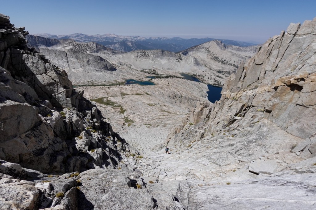
We split into two groups due to the loose chute. As Noe and Bridget started to descend, rain began to fall, and the clap of thunder was not far behind. It soon became clear that the chute was not trivial at all. After dropping a few hundred feet, sheer cliffs lay beneath us as far as the eye could see. We contoured right and contoured and contoured and contoured, but no relief was in sight. All this while the storm gained intensity. Hail and rain made for slippery footing. It was an intense situation to say the least. We took turns looking for cairns. Finally the rain let up, and we reached a ledge system that looked promising. The whole route is allegedly class two, but it seems that everything is a grade below what it should be out here.
At last we made it off the wide ledge that seemed to go on forever and onto real class two ground. We descended down to the lake and sheltered under a rock just as the storm began to regain steam.
We sat under the rock and debriefed on the wild day. I apoligized for dismissing Noe too quickly when he brought up the possibility of turning around. Bridget and Carlos both admitted they wanted to continue as well at that point, so I felt a little less bad. Everyone just seemed happy to have gotten down safely, and to have enjoyed the adrenaline rush of our brush with the storm on the summit. We went for a chilly swim in the lake and settled in for the night.
Day 5
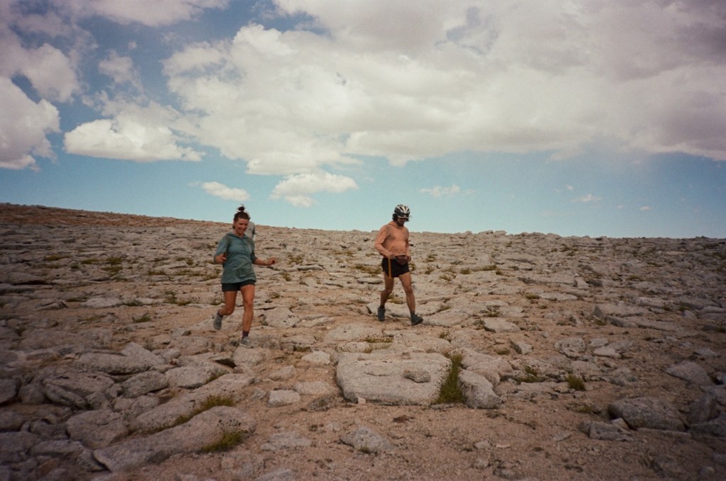
We awoke at 4:45 am again in order to beat more forecasted storms. I yelled 15 minutes!, 10 minutes! etc. to rally the troops for our 5:30am start time. We made exceptional time on Midway, and soon were all taking in the views at the top together.
Soon, we were descending towards Milestone. Noe and I had a minor difference of opinion over navigation, and I suggested we split up briefly. I didn’t want to walk on snow after my near miss the year prior. We split up as I suggested, but when we got back together, I found I had really struck a nerve with Noe. An animated discussion ensued about splitting up, where we rehashed situations from yesterday, and years prior. Our pace quickened as the conversation intensified.
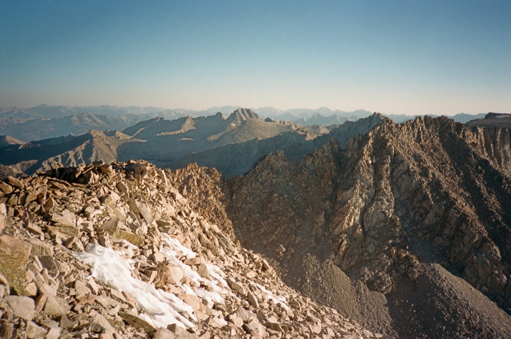
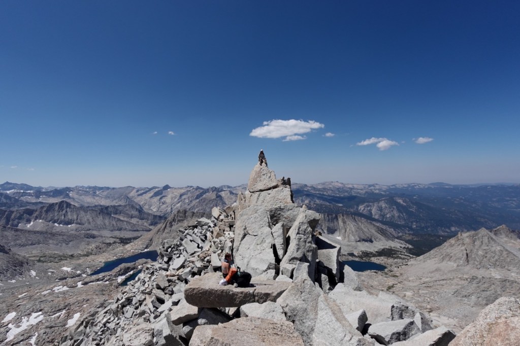
Before we knew it, we were at the top of the climb up the chute on Milestone. We had both said what we wanted to say, and whatever conflict had bubbled over had now melted off, we hugged eachother and discussed the nine years of trips that we had shared together fondly. Talking things through can seem daunting, but in many cases it is the best way to move through conflict. Conflict comes to a head, and then dissipated quickly, just like a passing thunderstorm. Peace and harmony returned, and we quickly moved through the few class three moves to the summit ridge. From there it was only a few more moves to the summitblock.
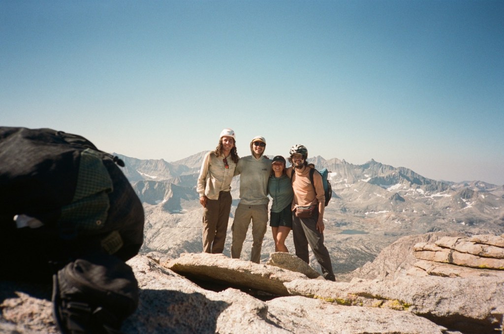
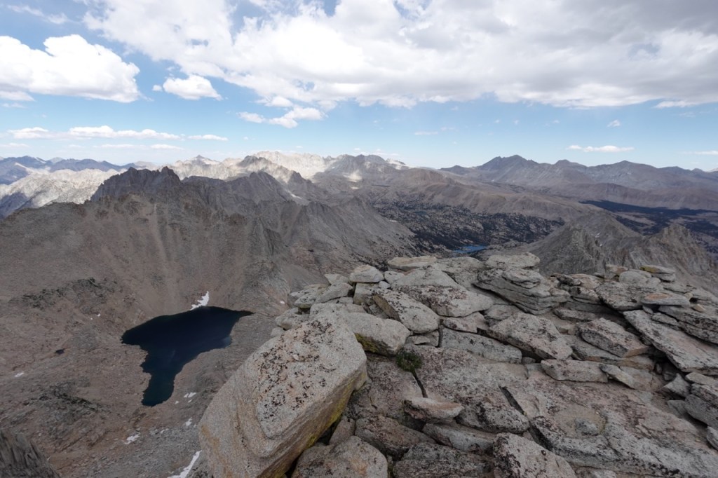
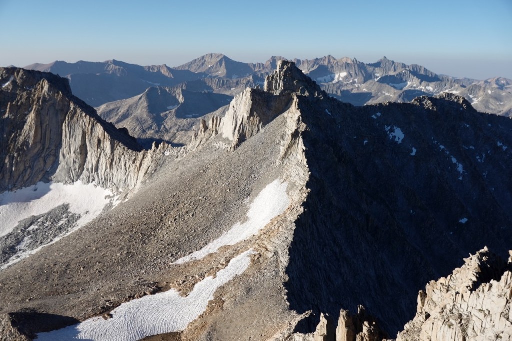
Victory was sweet. We had sumited all 8 peaks that we wanted to against all odds. We hugged and took a few pictures to celebrate. On the horizon to the south lay the Kaweahs and many other enticing peaks, but I felt satisfied having climbed some of the most remote peaks in the range.

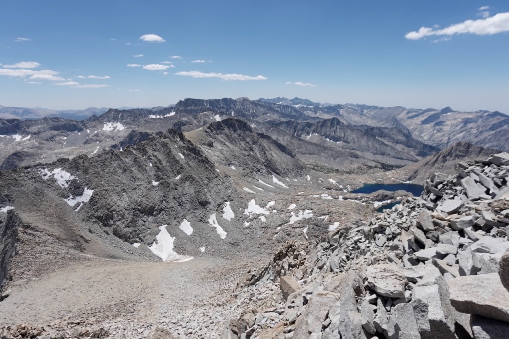
We all descended together. There isn’t much to talk about 5 days into a trip, so the periods of silence were longer, but we were all still enjoying each other’s company. As we continued on down the drainage, Milestone began to look more and more unlikely. We had been up there just hours prior, but it now looked almost impossible.

We took one final swim, no longer worried about storms or time or any of it. Soon we were crossing the Kern, and back on real trail for the first time in four days. Another storm did come for us while we were on the trail, and we set up our tents to wait it out. The storm rattled around all around us, but after yesterday, we were not that phased.
We got a nice rest in and the storm passed. We debated camping there, but reinvigorated from the rest, we continued on. Somehow we threaded our way across the PCT without seeing a soul. We setup camp at 7pm at the pass. Carlos began sprinting furiously up Tyndall into the fading light.
The rest of us gazed back at the now impossible looking Milestone. The last few days all felt exactly how Milestone looked from the other side of the valley — an impossible combination of beauty and remoteness. The thunder storms, the class four sections, it didn’t even all seem real. I turned over all of the events of the last few days. Those big mountains had forced such an intense presence, that I didn’t really think about it all coherently until now. So much was packed into those 3-5 mile days. It didn’t even all seem real, but it was. We had completed the traverse, and hiked eight peaks to boot. The dreamy separate bubble of reality we had created was about to pop. Now we stood on the edge of the Owen’s Valley and the Kern, and began to prepare for our return to civilization the following day.
I set up Carlos’ tent for him. At 8pm we heard a triumphant shout. Carlos had reached the summit of Tyndall just before last light. One hour from pass to summit. We chatted intermittently as we lay there peacefully, watching his headlamp slowly descend the mountain. By 9pm, Carlos was back and we all drifted off into a deep sleep.
Day 6
On the morning of our final day, we started a bit later and began the walk down Shephard Pass. The hiking went quickly. It was not until halfway down the pass that we saw our first people since day 1. We met another Mammoth resident named Shannon, who was working on the SPS list with her husband. The temperature climbed considerably as we descended, but we just kept putting one foot in front of the other, and soon we were at Carlos’ bus. We celebrated completing such an incredible trip, but all were also a bit sad to leave the peace and quiet of the wilderness behind. We drove back to Mammoth, and a few hours later were all dancing at Music at the Mobil with friends. What a trip.
Digital photos below:


Forecaster Noé put together a new website called eastsideweather.com. This is the go to spot for all your Eastern Sierra forecasting needs.
