


My friend Sienna invited me to join her and her friends on a weekend of trail magic on the Pacific Crest Trail. We planned to hike 11 miles into the beautiful Leconte Canyon. Of the group of 8, 7 of us had hiked the PCT previously. I slept at the South Lake trailhead, and met up with the group in the morning. Sienna had to take a work meeting, so she wasn’t able to start for a few hours.
Collectively, we packed in food to make falafels, pancakes and a few other treats for hikers. I carried about 10 pounds of trail magic food in a grocery outlet bag, hanging on the outside of my pack. This definitely pushed my homemmade frameless pack to its limit, but luckily we took frequent breaks, along the climb up the pass. The couple from San Francisco was starting to really feel the altitude, so the pace slowed down considerably near the pass. We broke for lunch about a mile past the pass, and I decided to take a nap and do some knee PT while I waited for Sienna to catch up. I figured it would be easier on my shoulders to do the miles at a quicker clip.

The group continued on, and I had a very peaceful sit under a tree. Even though Sienna started 4 hours behind us, it was just over an hour until she caught up. She was relieved to hear she had almost caught the group, and I assured her we would likely catch the group very quickly. We caught the group even more quickly than I expected. They were taking a break at a lake a mile or so down the trail.
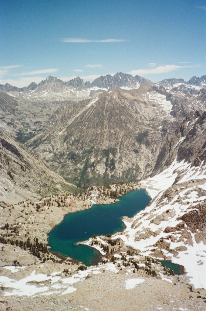
As we neared the switchbacks, sweeping views of Leconte Canyon greeted us. The mighty Middle Fork of the Kings roared some 2500 feet below. Langille and its imposing north face saluted us from across the canyon. As an SPS peakbagger, I am always looking for an opportunity to tag an SPS peak. I had already climbed all of the easy ones in the area. I had considered McDuffie, but ruled it out as the Middle Fork was running very high.

As we approached the bottom of the canyon, I spied a huge mass of trees that had fallen across the Middle Fork. Perhaps there would be a chance of crossing safely after all….
We setup camp, and met Natalie’s friend Amanda who was the ranger for the summer in Leconte Canyon. Amanda and I instantly hit it off, talking about all things Sierra. It also turned out that I knew her husband Rick from playing frisbee in Bishop. Small world! I had a lot of questions about what it was like to be a backcountry ranger, living deep in the Sierra for the whole summer. Amanda mentioned that she wanted a break from the noise of the outside world, and didn’t want to cross Bishop Pass all summer, even on her days off. She enjoyed talking about all of the obscure corners of the range with me, in contrast to having the same conversation with the PCT hikers over and over. Having hiked the PCT and explored the Sierra, I certainly see the value in both. However, it is a shame that many hikers pass through the range of light, without fully appreciating it.
I set my alarm for 5am the next morning. I made a halfhearted effort to convince the rest of the group to come, but I knew it would be best to go alone. Amanda warned me that McDuffie would be a big day, with “infinite scree” on the final ridge. I would probably miss most of the trail magic, but I had done my duty of carrying in 10 pounds of provisions.
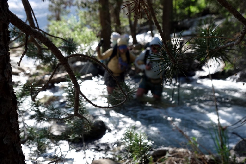
Early that next morning, I hit the trail within a few minutes of my alarm. I exited camp silently and did not cause even a stir amongst the group. Within a few minutes, I was crossing the mighty Middle Fork on the fallen logs I had spotted the night prior. The logs were a bit slippery, and the Middle Fork’s flow appeared very formidable, inches from my feet. A fall here would likely result in a violent thrashing drowning down a waterfall with a funeral procession all the way down through Tehipite Valley and beyond. I shuddered at the possibility, and took my time, getting on my hands and knees and carefully making each step.
Soon, I was across the river, and charging through the brush. I had to contour awkwardly for a mile or so to get to the correct canyon, but then I was able to start climbing steeply through the woods. The forest provided for quick travel, and before I knew it, I was at the beautiful Bench Lake.
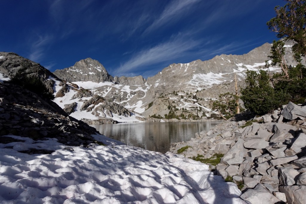
The climbing relented briefly near Bench Lake, but as I reached the other side, I began a 2,000 foot charge up to the ridge. Now, I was on the roof of the Black Divide, one of the more remote ranges in the Sierra. I was making great time. I had left camp just three hours ago, and I had already climbed some 4,000 feet over very rough terrain.

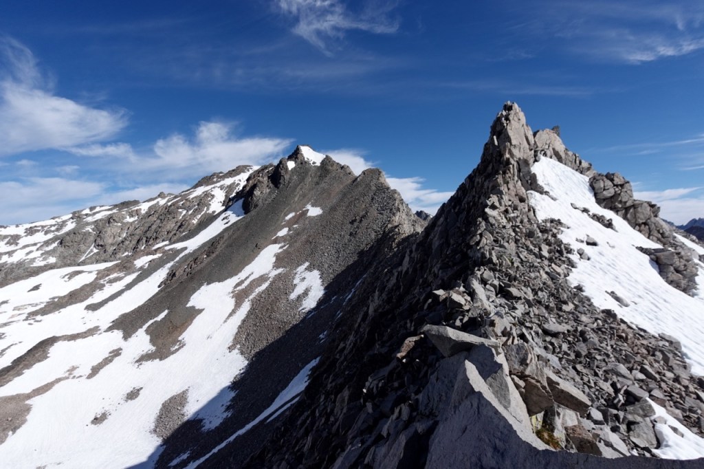

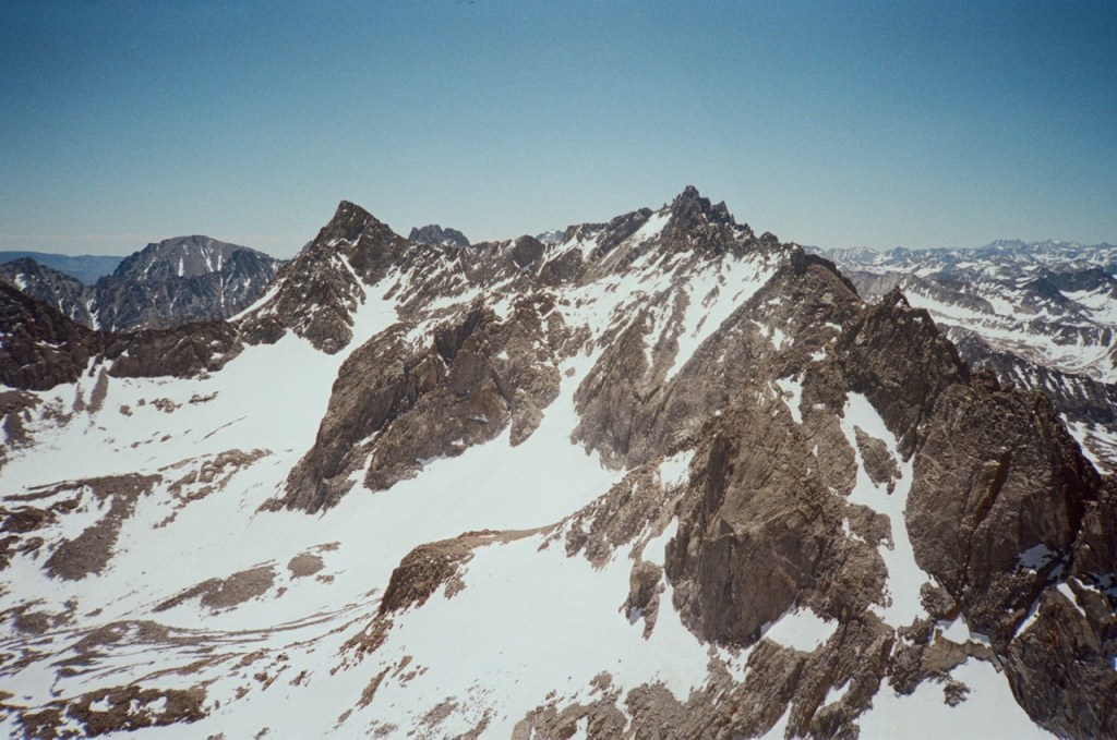
I gazed out at Devil’s Crag to my south, the Palisades to the East, and McDuffie, only a mile away now. Most of the climbing was done, and now only a mile of heinous scree separated me from McDuffie. Amanda’s warning was correct, the final mile took almost an hour and a half to traverse to the summit. I certainly felt the remoteness being out there all alone, separated from home by the Middle Fork and the Sierra Crest. I took in the surreal beauty of it all, and continued to make steady progress towards the summit.

Finally, after 4.5 hours, I made the summit. I took in the views and had a snack. I was the first name in the register in almost a year. The last entry was from Kim Gardner in August 2024. I feasted my eyes on the panoramic views. I was in the heart of a very beautiful part of the range. The Palisades stood proudly across the other side of the canyon. Devils Crag was below me now, but its knife edge ridge appeared no less formidable. Far far below to my west flowed the enchanted gorge, a notorious draignage that flows in to Lower Goddard Creek. I recalled the adventure I had had in Lower Goddard fondly. And then Goddard and the Evolution peaks towered to my north. It was truely hard to decide where to look in my short time on the summit. I didn’t linger as I did not want to leave the group worried.

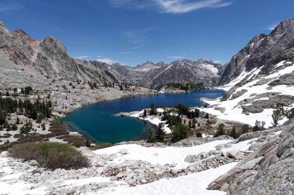
I was able to make slightly better time on my way down, and soon I was approaching the beautiful Bench Lake, an infinity pool reflecting the Palisades from across Leconte Canyon. This serene lake, with the mighty Langille rising from its southern shore, is surely one of the many beautiful spots just a few miles off the PCT that sees almost no visitors.

I made great time along Bench Lake, and walking through the forested slopes beneath it. Soon I was back in Leconte Canyon, walking through the brush in the midday heat. I had about a mile to go to get back to my log crossing, and cross to safety. I began to worry that with the heat the Middle Fork had risen, and my log crossing would no longer be as trivial. With half a mile to go, my nerves quickened my pace to a trot. I spotted some PCT hikers on the east shore of the river, and started racing them. Somehow, even without the help of a trail on my side, I quickly pulled ahead. When I got to the river, I was relieved to see the water levels had only risen a few inches. I took similar care to my morning crossing, and let out a scream of relief upon reaching the far bank, startling the PCT hikers I had been secretly racing. I jogged the last 0.2 miles, relieved to be back across the river safely. I was greeted with cheers of relief by the group.


The trail magic had gone remarkably well. Over 50 hikers had been fed, and we lifted a lot of spirits tremendously. Upon my return at 2pm, I had been gone for 8.5 hours. The food lasted another hour and a half until we ran out. Each hiker was given a pita with falafel mix, vegetables and dressing, along with pancakes and other food. Each of us only took one pita each in order to maximize the amount of food for the hikers. As I sat along the PCT hanging out with the hikers, in many ways it felt the same as it did seven years ago when I hiked it. The main difference I noticed, was that everyone seemed to know exactly where everyone else was on the trail. “How do you know your friend is 15 miles ahead”, I asked, “did you see a southbounder?” The answer was that the new iPhone allows satellite texting. A seemingly small change, but yet another example of the insidious creep of technology even into the last few serene corners of the earth like Leconte Canyon.
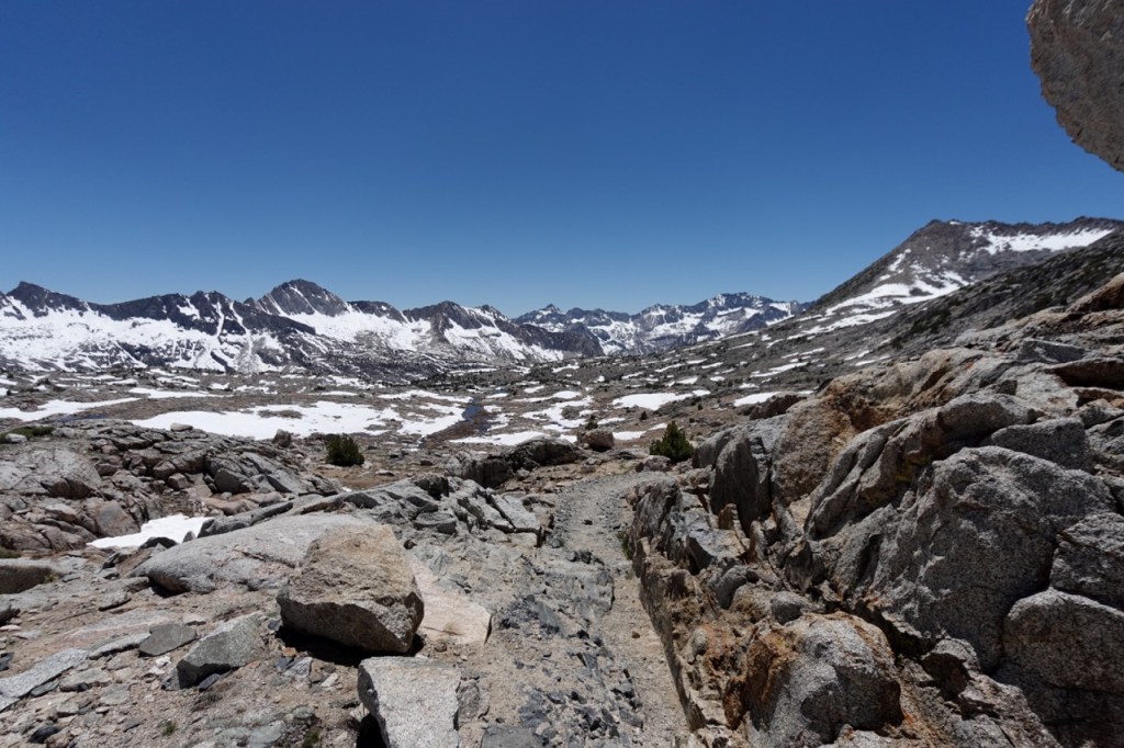
Soon, we packed up and began the 2,500 foot climb up to Dusy Basin. I was exhausted from my trip up McDuffie, but hiking with a group kept me going up the steep switchbacks.
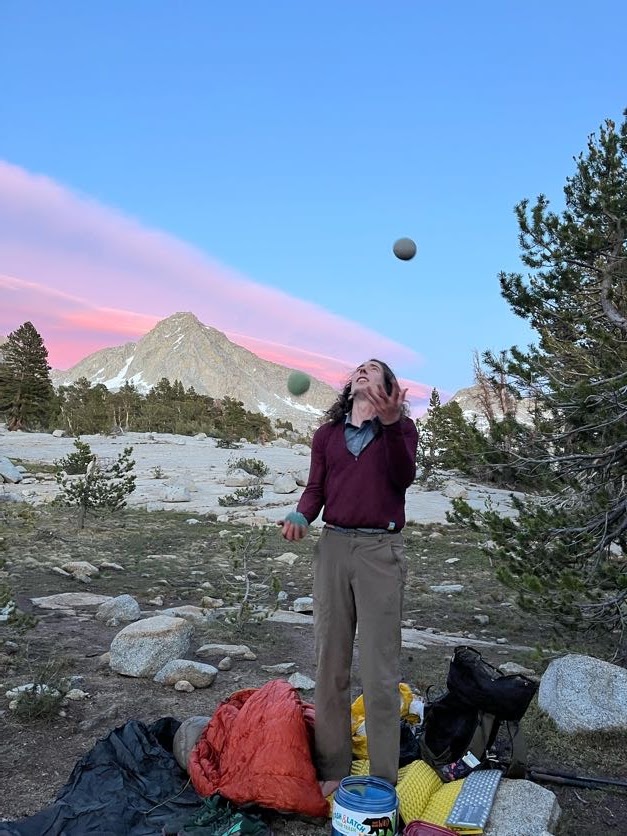
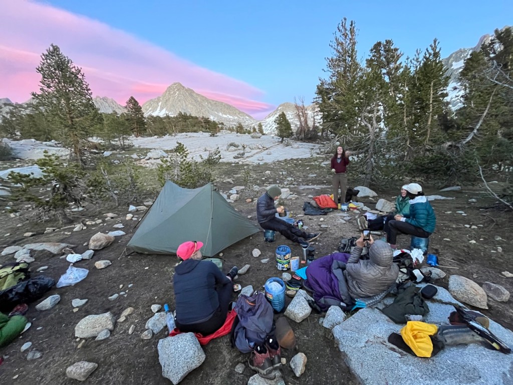
Soon, we neared the hanging valley where the trail mercifully flattens out. I gazed back across the valley to McDuffie which seemed so far away. Ranger Amanda showed our a nice secluded spot in Dusy Basin and we set up camp. We spent one more night together as a group, before parting ways the next morning. The sierra wave shone bright pink over the palisades. Amanda requested a juggling lesson. She videoed a 3 minute stretch of me juggling, which she said she planned to watch hundreds of times over the course of the summer. This would give her something to do in Leconte Canyon. Boy, the peace and quiet of being a backcountry ranger was sure sounding more and more tempting.
Part of the group planned to hike back to Bishop pass. Sienna, Natalie and I hiked Mt. Agassiz. I had hiked this peak before, but I wanted to see the view from the summit again. As we neared Bishop Pass we met up with Andrew whom Natalie knew from SAR. A hiker had gotten rescued after a glissade gone awry on Mather Pass, and Amanda had carried her back up to the pass. Andrew brought the hiker’s pack down to the hospital in Bishop. As it turns out, Andrew is also an expert sewer, and offered to give Sienna, Natalie and I a tour of his workshop the next day. I showed him my homemade pack, and he offered to help me strengthen the shoulder straps, which had fallen off on a recent trip into Death Valley. We thanked Andrew for his generosity and said goodbye to Amanda. We began the 2,000 foot climb up Agassiz.


Agassiz has incredible views of the Palisades just to the north, and the Black Divide back to the west. I am glad I got to hike it a second time.


As we were leaving the summit, we ran into some other hikers from Bishop, a few of whom knew Natalie. Mid-june really feels like a secret season, only locals and PCT hikers are out here in the range. We descended back to Bishop pass, and I glissaded down the massive north facing slope. This allowed me to sit under a tree and rest for twenty minutes while I waited for Sienna and Natalie.
We ran into Natalie’s boyfriend who was fly fishing in the river and then we all walked together for the last few miles to South Lake. For such a short trip, it really felt like a true adventure with all of the twists turns and people we met. I hiked Emerson the next morning, and then met Andrew Sienna and Natalie down in the heat of Bishop the next afternoon. Andrew graciously fixed my pack within a few minutes on his crazy machine. It has been holding up great ever since.
