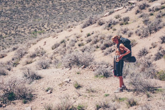
After going to Zion and completing my first 40 mile day hike(a story for another post), Evan(a person I met through the hiking club), Jeb(my roommate) and I decided to head to Death Valley in order to spend a few days backpacking in a much less crowded place.
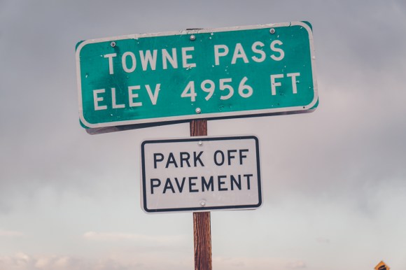
On my high school’s trip to Death Valley we entered through Marble Canyon hiked to the racetrack, across Saline Valley, into the Nelson Range, back across the bottom of Saline Valley and eventually exited over Towne Pass. I figured that a trip entering at Marble Canyon, cutting down to Cottonwood springs and then out Towne pass would be a good introduction to desert backpacking for Jeb and Evan, without having to carry a ridiculous amount of water.
Emma and Powell, the other two people on the trip generously agreed to drop us off at the mouth of Marble Canyon and meet us at Towne Pass in three days time.
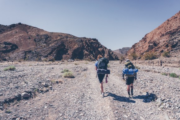

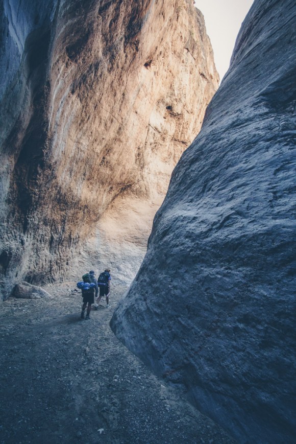
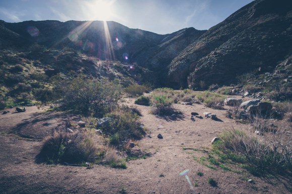
The Marble-Cottonwood loop is the most (and really only) popular backpacking loop in Death Valley. It is a good first route because there are two reliable springs, most of the navigation is in canyons and it is a loop so no hitchhiking is needed. As it was spring break we did see a few other groups out there, but none after deviating from the loop at cottonwood springs. Cottonwood Canyon is much wider the Marble, and has no narrows, as such I chose to exit over Towne pass instead.
Navigationally speaking, most of the route is quite simple because it follows Marble and Cottonwood Canyons, however the crossover can be quite difficult for those not adept at desert navigation. With a map and compass, we had little trouble finding the route but we met a group of people about our age that told us they had gotten lost in the hills between the two canyons for over a day. This potentially deadly predicament could have been easily avoid if they had brought even a map and a compass and learned how to use them.
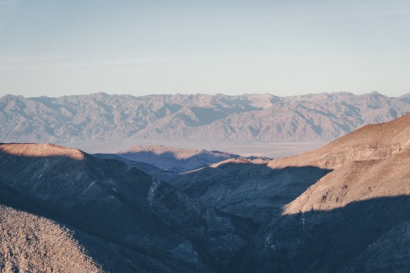
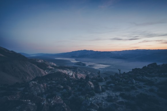
We rested at Cottonwood springs during the heat of the day and then made our way south towards Towne pass. Just before setting up camp I climbed a steep hill and was treated to a beautiful view of Panamint Valley.

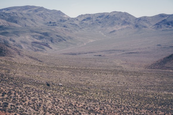
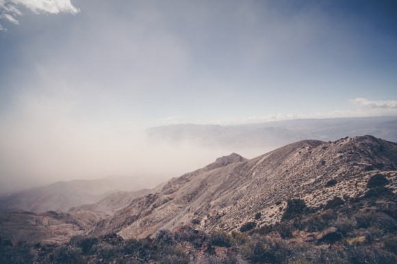
Once we made it up to the ridge of Towne Peak the next day we were shocked by how fast the winds were. Death Valley was experiencing a massive windstorm, much bigger then usual. It was difficult to move along the ridge and what should have been panoramic views were obstructed by the dust blowing around in the valley below.
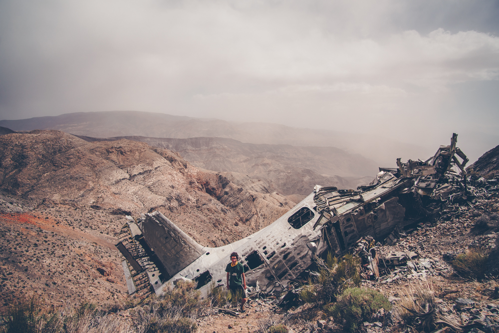
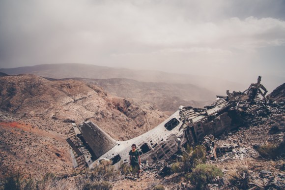
Upon reaching Towne Peak Jeb was very tired and wanted to go down, Evan and I wanted to see the site of the Albatross plane crash only a mile south of the peak, thus wee split ways, admittedly not a good idea in the desert.
Upon arriving to Towne pass we did not see Jeb, I mistakenly thought he may have gotten lost on the way down. However it turns out that he had just gone into the closest town to get out of the wind. Evan and I were very worried though. Some people gave us a ride to a place where we could call him, and we soon found out he was safe. The moral of the story is not to split up, especially with a new backpacker. It was still very windy and it was getting dark. Emma and Powell were still nowhere to be found. It turns out they were delayed because they had to plow sand off some of the roads from the windstorm. We turned down multiple rides but eventually decided to go to Panamint Springs to get some food and wait for them. Unfortunately this caused more confusion but eventually they found us. Good bye Death Valley.