
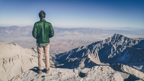
Looking back on this weekend it is still one of the craziest weekends I have ever had. We crammed two hard trips into one weekend in two of my favorite areas in the United States (Death Valley and the Eastern Sierras)
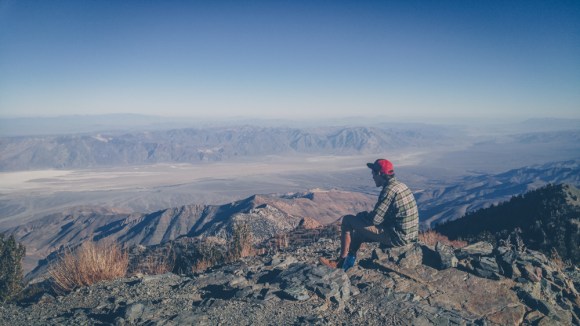
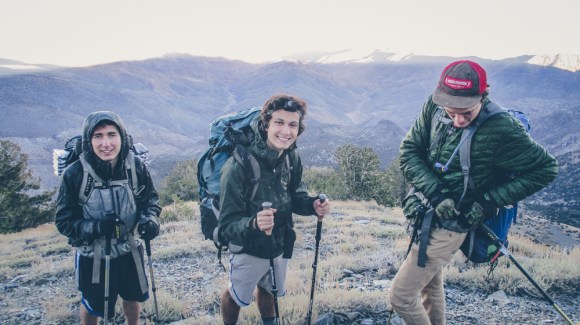
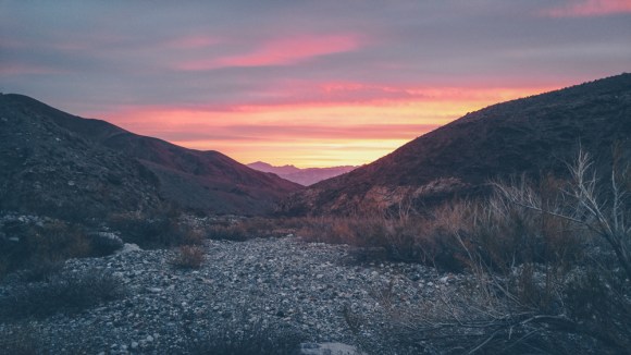
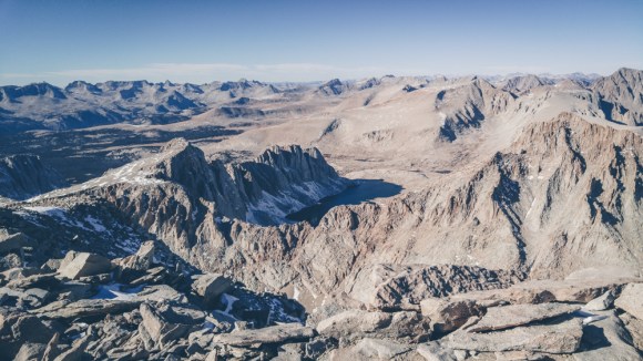
Veterans day is only one of two three day weekends in the fall term and I planned to make the most of it. Originally the Matt Noe and I planned to head to Death Valley and do a trip there. When we heard that our school’s hiking club was planning to do a trip to Mt Whitney, we jumped at the opportunity to meet some new people at UC Berkeley and also climb the highest peak in the lower 49. Matt Noe and I went to the planning meeting and we met Jared, another person i would go on to do many more trips with, and Kristian, a very adventurous and some would say crazy exchange student from Norway. We convinced them to still summit Whitney with us but also come along for a detour through Death Valley. We all drove in Matt’s car down to Death Valley where we planned to hike the 11000 foot Telescope Peak, the highest point in Death Valley. I had always wanted to hike from Telescope to Badwater and somehow I convinced Matt and Noe that it despite the limited timeline it would be a good idea.
Jared and Kristian wanted to save their energy for Whitney but they graciously agreed to pick us up at Badwater Basin some 20 miles east the next morning as they wanted to see the rest of Death Valley as well. We got to Death Valley around 4am and slept at Emigrant Campground.
(pictures taken on my phone and a few on Kristian’s pocket camera)

By the time we had hiked the 7 miles to the top of Telescope peak and descended to our chosen drop off point along the ridge it was already around 4pm and there was not much daylight left, however it was the full moon and we decided to descend anyway.
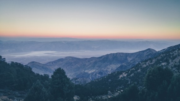
The descent was very steep and much slower then we anticipated. Although it was all downhill there was some tricky route finding especially at night. Although the section between the telescope peak trail and the Hanaupah canyon road looks short on the map, it takes a long time to descend. Most canyons in death valley end in steep and in passable dry falls so we had to take numerous reroutes.

The shear size of Death Valley makes things feel deceptively close, a similar effect to the lack of depth perception in the dark. The combination of the two was all the more deceiving. It is pretty hard to navigate in Death Valley as many of the peaks and other landmarks look very similar, this navigaational challenge was further compounded by the lack of light. Finally at 2am or so we finally reached the wilderness boundary meaning we had reached the 4wd “road” we still had over 15 miles to go though, but at least it was on an easy to follow and somewhat flat path.

We decided to sleep for three hours and wake up at 5 am in order to get to Badwater at a reasonable time.
Once we got to the mouth of the canyon we still had to descend 6 miles on the alluvial fan and then cross the 5 mile salt flats.
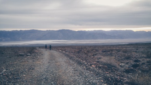
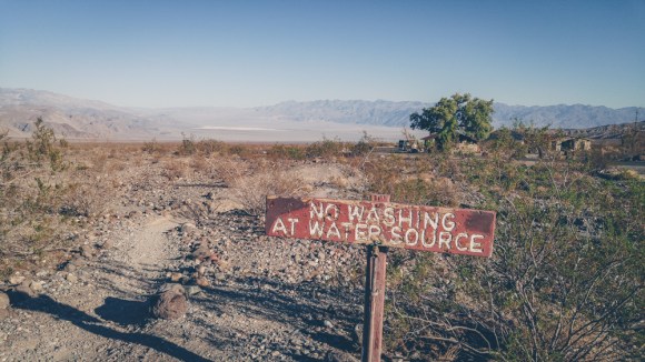
I’ve crossed Badwater Basin twice and both times were incredibly difficult both physically and mentally. The black mountains and the Panamints are both massive mountain ranges so even after walking for an hour it is impossible to tell that you have moved at all. People have died in Badwater basin after wandering a couple hundred feet from the road and becoming disoriented, unable to see the road and know which way to go.
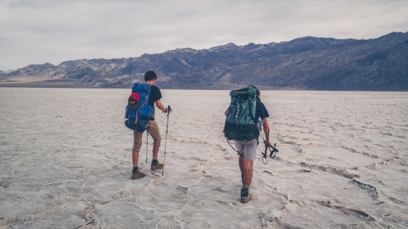
Finally we reached Badwater Basin just as Jared and Kristian were starting to worry that we had become lost out in the desert.


Luckily Jared drove the 135 miles to Mt Whitney and Matt Noe and I got some much needed sleep. But by the time we packed all of our stuff, and stopped for food and permits in Lone Pine it was already 4pm. Nonetheless we began to head up Whitney.
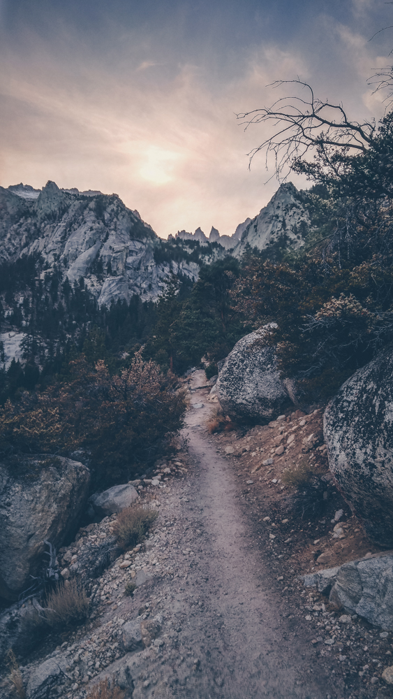

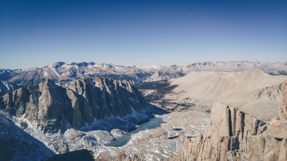
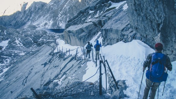
As we got to Outpost Camp at 10,000 feet we ran into the group of 15 students from UC Berkeley who we had originally planned to go with. They had just summited earlier that day and were very suprised to hear about our adventure in Death Valley. We wished them well and continued up the mountain to Trail Camp at 12,000 feet.
It was 9 degrees that night but Matt and I were so tired we slept outside anyway. After two nights of just three hours of sleep we finally got a decent 7 or so hours. The next morning we woke up and had to melt water before proceding.
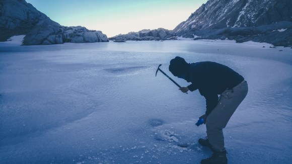
At around 9am we finally had enough water and we proceeded up the switchbacks, as we got higher we soon began to feel the altitude.


We got back to the car around 8pm and had an 8 hour drive ahead of us. We had to take turns many times on the drive back in order to stay awake. Despite this we still stopped at Manzanar internment camp on the way back and did the driving tour because Jared is a History major and wanted to see it. We finally got back to Berkeley at 5am Monday morning. Even though my outdoor skills have advanced a lot since this trip, I still maintained it is the most ambitious weekend trip I have ever done.
