
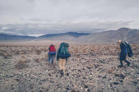
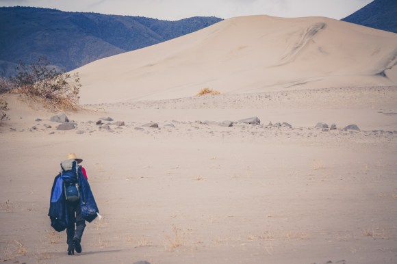
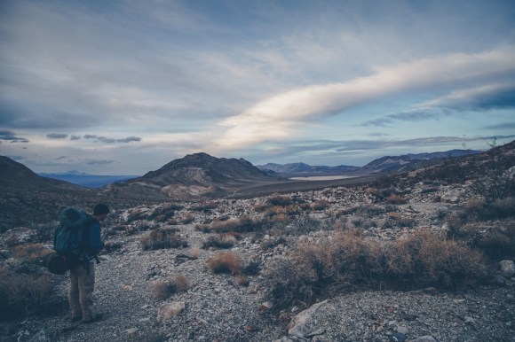
My friends Ira Emmet along with my brother Connor and I all set out to go on a backpacking trip to Death Valley, one of my favorite places in the state. It was all of our winter breaks and it was great to see them after being off at college. We planned a very ambitious route from Panamint Valley, over the Panamint Dunes, up Mill Canyon to the southern tip of Saline Valley and then through Grapevine Canyon, up to the Racetrack, and then up White Mountain road and down and out Bighorn Gorge to Death Valley itself. Special thanks to Steve Hall from http://www.panamintcity.com without which we would not have been able to link together this route.
Well there are many reports of people doing part of this route, I have never heard of anyone doing the whole thing as backpacking is not very common in Death Valley. We pieced together a very aesthetic route in my opinion that hits most of the highlights of the Cottonwood Mountains. I would recommend that anyone who attempts it be in extremely good condition, and perhaps to travel faster and lighter then we did to lessen the hauling of heavy loads. There is only one spring on this route in Grapevine canyon so we had to be prepared to carry up to 12 liters(26 pounds of water) at a time. If one was prepared to travel lighter they could perhaps lessen that, but be warned off trail travel in Death Valley is typically at least twice as slow as on trail travel.
We all learned a lot on this trip, firstly to always check the shelter before going on the trip. Emmet brought a tarp on the trip but none of us brought poles so in the mostly creosote bush that fill Death Valley there was no place to set up a tarp. We soon came to regret this decision a lot.
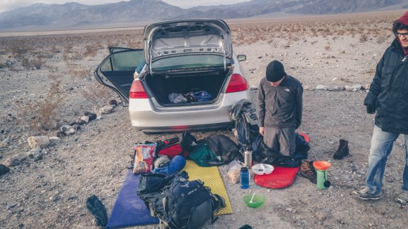
On the first night we drove to the end of the road in Panamint Valley and camped there for the night. The next morning we gathered our gear and set off into the desert.


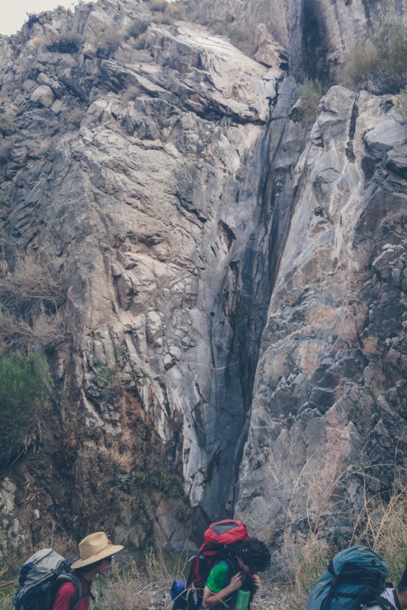
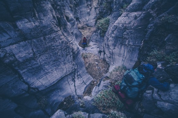
Most canyons in Death Valley have large dry falls that need to be bypassed. Sometimes this can be easy sometimes it can be difficult, most of the dryfall bypasses on this route were fairly straight forward. More information can be found on panamintcity.com

It got dark and the climb out of upper mill canyon was quite difficult, a few hundred feet straight up a hillside. Finally we made it to South Pass road which had a thin layer of snow on it. We walked about two miles down the road before we found a small clearing beneath the road to camp at. Unfortunately we did not set the tarp up out of exhaustion and woke up in the middle of the night to wet sleeping bags from the rain. We tried to jerryrig a setup off of a small bush but we were not very successful.
By the morning the rain had stopped and we decided it was safe to keep going, we were all still quite warm and we would dry out gear out that day.

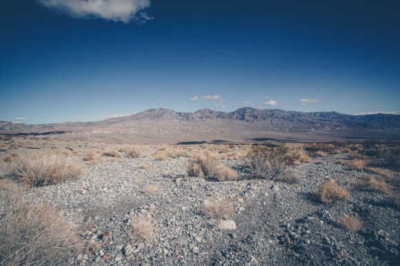
We continued down south pass road for two miles until we reached grapevine canyon, the location of the first and only spring. We all came to Grapevine Canyon on a backpacking trip in High School so it was neat to come back at a different time of year.


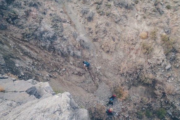
We filled our backpacks with water and started the climb up to the racetrack. With full packs it was very slow going and the navigation was quite tricky, this part of the trip took many hours.

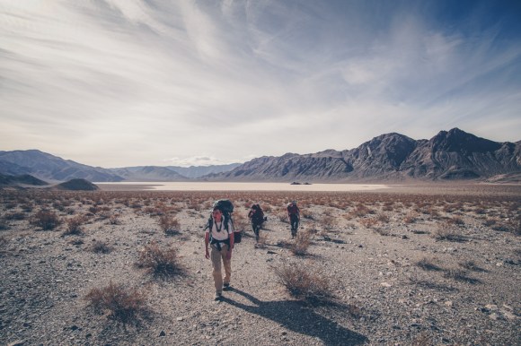
Suprisingly between the racetrack and grapevine canyon we ran into two people one of whom went to our high school. It is extremely rare to see people in Death Valley, but since out high school did a trip to this general area, it was actually not too surprising. After a few more miles heading North we finally got to the pass and got our first view of the Racetrack.
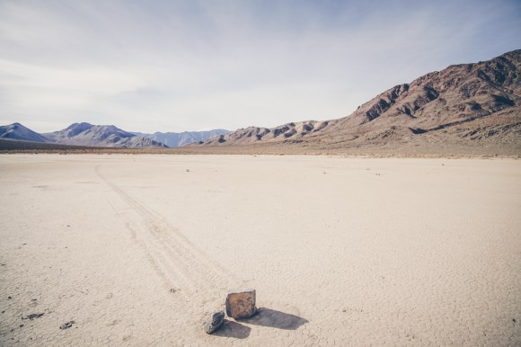
We neared the racetrack and camped for the night, the next morning we explored the racetrack and checked out the Sailing Stones. Unfortunately there is a lot of damage to the Racetrack due to people driving on it. Many of the Sailing Stones have been stolen. It is my opinion that it is far too easy to reach the racetrack. In recent years the road has been heavily graded so even some brave 2wd cars can make it out. I understand that not everyone can walk in as we did, but they should at least close the road a few miles down, and maybe have a few guided tours for people that are not physically able to make the walk. If they do not do this all of the Sailing Stones will soon disappear and it will be just another dry lake bed.
Furthermore NEVER walk on the racetrack when it is wet as it will take years to heal, unfortunately you can see a lot of foot prints near the sailing stones, evidence of people walking on the area during rain.


From the Racetrack we headed Northeast up into the Mountains via White Top Mountain Road, we mistakenly went up a side canyon in an attempt to save time but it ended up costing us a few hours. We walked into the night and didn’t arrive at the end of White Mountain Top Road until almost 11PM, this was one of the only sections of our route on roads but Ira had some pretty big blisters at this point, this combined with general fatigue slowed us down.
That night we awoke to about an inch of SNOW on top of our sleeping bags at 3am. Emmet quickly took charge and suggested packing up and resuming hiking to warm up. Luckily the snow soon stopped and we hiked down into Upper Big Horn Gorge into the darkness. Soon enough though it became light and our pace quickened.


Connor and I made it to the road around 3:30 after splitting up from Emmet and Ira in order to have a better shot at getting a ride out that day. Ira’s foot was really bothering him due to blisters which really slowed him down.
Still 60 miles from our car we were not out of the desert yet. We budgeted for a long wait for the hitch with lots of water, however we got very lucky and the first car that passed by stopped, a very nice family visiting from China, and they took us to Stovepipe Wells.

The next two rides came quickly as well and I ran the last 6 miles on the dirt road to the car while Connor waited with our packs, we then returned 60 miles to pick up Ira and Emmet who didn’t get to the road until around 7pm. We then headed home, goodbye Death Valley.
We were all quite exhausted from getting up at 3am that day so we switched off drivers every two hours in order to make it back home. Connor had school the next day which he somehow went to after getting home around 5am.
