Categories
Uncategorized

Mexico: Climbing Citlaltepetl and Iztaccihuatal

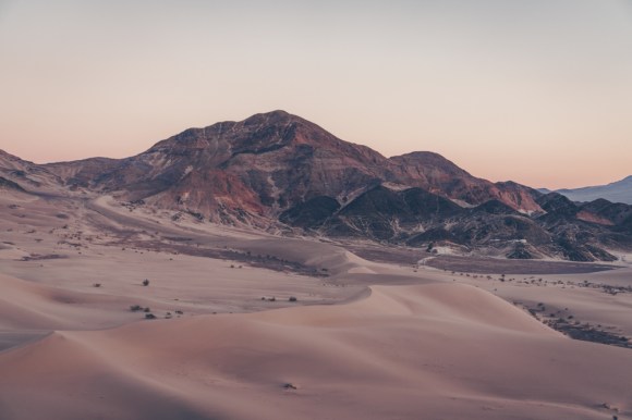
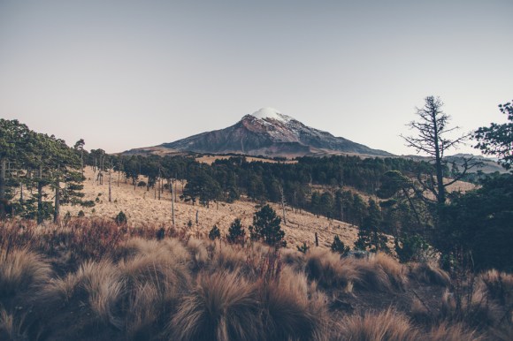
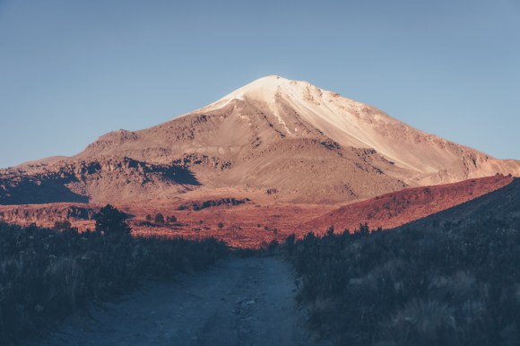
Matt, Adam, Anthony and I set out to Mexico to attempt to the climb the 18,491′ Citlaltepetl (Pico de Orizaba). This volcano is the highest point in Mexico and the third highest point in North America. This was my first time going outside of the United States or Canada in a long long time and I am really glad that I did. Furthermore we got to see a part of Mexico that many American tourists never get to see.

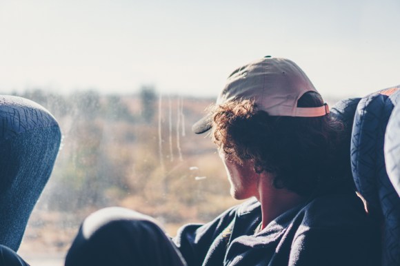
I got in early and on the first day we took the bus from TAPO to Ciudad Serdan, from there we took a combi(a small very cheap van that fits about 10 people and serves routes less crowded then bus routes) to Tlachichuca

DSC00305.jpg
Matt looking out the bus window
DSC00316.jpg
Orizaba as seen from Tlachichuca

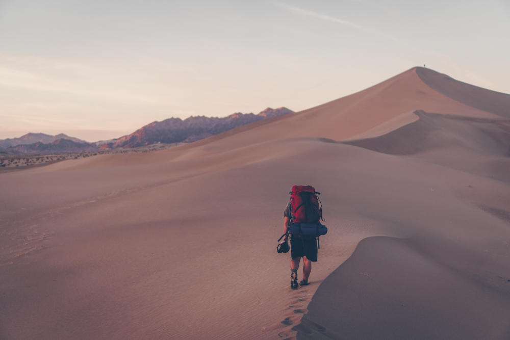
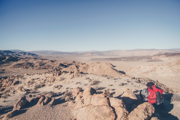
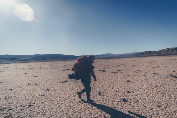
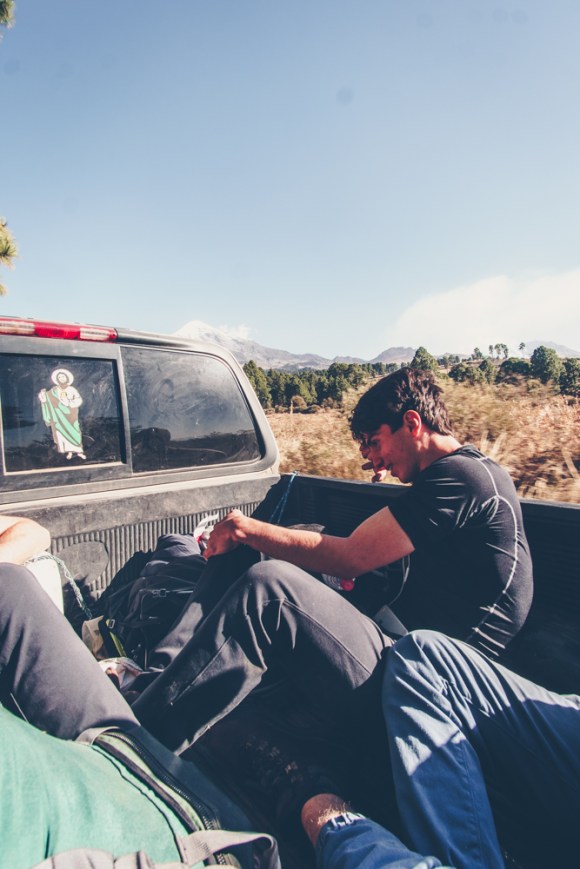
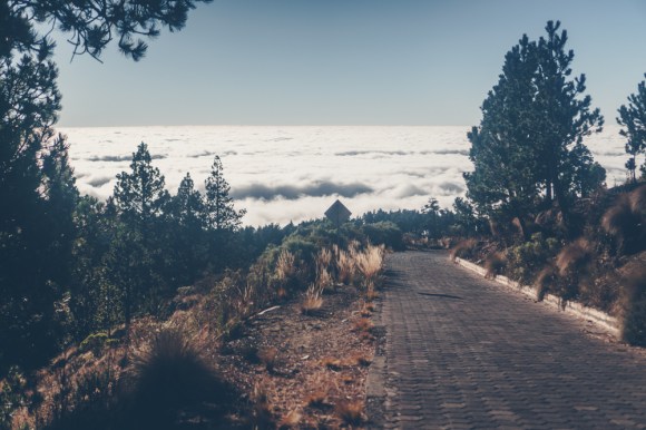
In Tlachichuca we talked to the local guide about a potential ride up to the base of the mountain. However it was very expensive, 1000 pesos each(about 50 dollars). He told us that it was a thirty mile walk but in reality it was only about 10-15. We decided that since we needed to acclimatize anyways it would be best to just do the walk up 7000 feet to the end of the road. Luckily we were able to hitch a ride for about half of it. If you take this strategy be sure to carry lots of water! We found a spring at the hut but apparently it is not always running.

DSC00319.jpg

After that we began to walk up the roads. There are many different intersecting roads and there is no good map. So, we just headed up steep hillsides and eventually got to the hut at the end of the road well after dark. We were now at 14,500 feet and were really feeling the altitude,

DSC00322.jpg
sunset over Mexico
DSC00333.jpg
Orizaba from about halfway up our improvised route
DSC00338.jpg
the hut

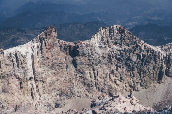
We talked to a few tourguides that came up that day and they said that the conditions were very bad on the mountain. The Jamapa glacier was very wind scoured as it had not snowed in a long time. A few people had died on the mountain last month. We were talking with the guides in spanish, their clients were from the United States. Not knowing that we spoke english, the clients said “these idiots are going up there without a guide and without ice screws”. The guides started to translate, ‘Ustedes van sin guia?”, but when we answered in english and the clients were quite embarrased. TWe decided that we could not safely complete this route and decided that we would try the route from the other side of the mountain. We paid one of the tour guides some money for a ride back down to Tlachichuca and then took a combi back to Ciudad Serdan.

DSC00347.jpg
driving back down the road we hiked up

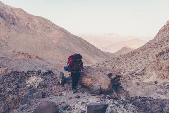
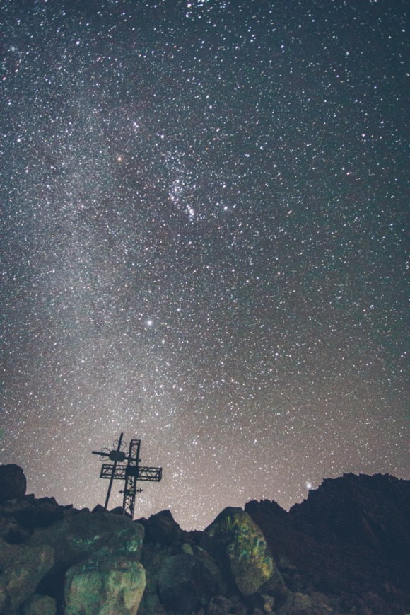
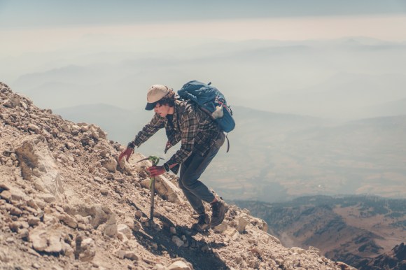
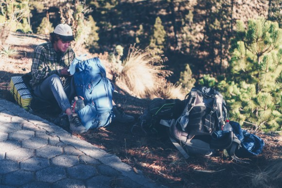
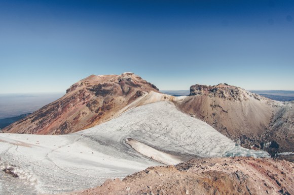
We took a taxi and then paid some people to get us a few miles from the hut on the other side of the mountain. Our packs were very heavy with lots of water, and we climbed to over 15,000 feet to spend the night at the hut. For the second night in a row we had a large hut to ourselves. The next morning we set off for the summit.

DSC00350.jpg
there are a lot of crosses everywhere on the mountain, many even use them as reference points to navigate
DSC00464.jpg
Anthony climbing up the steep scree
DSC00467.jpg
Matt at around 18,000 feet
DSC00470.jpg
looking across the crater at the top
DSC00477.jpg
Matt celebrating at the top
DSC00494.jpg
group picture at the top
DSC00473.jpg
The top of Mexico

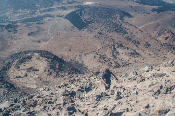
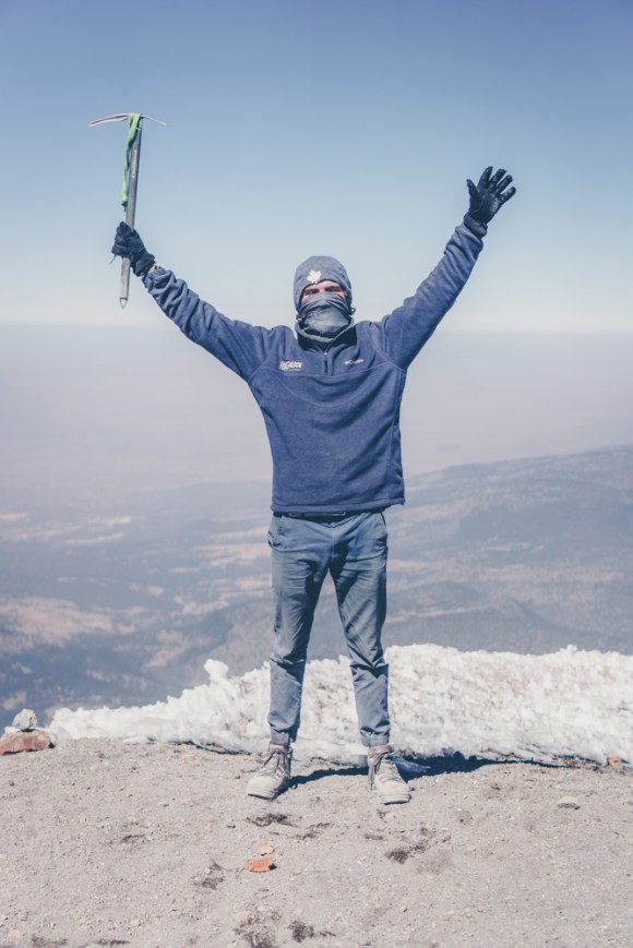
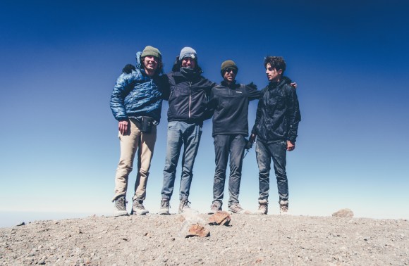
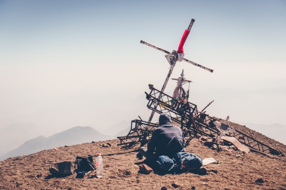
Matt and I arrived at the top 45 minutes before Adam and Anthony and spent some time relaxing and taking in the view. By the time they got there they were feeling sick so we descended almost immediately. Anthony was starting to display symptoms of HACE so Matt and I had to guide him down as quickly as possible. It may be tempting to not acclimatize on this climb as the summit is only 4-5 hours from the hut, but do not be tempted by it. Even after spending a few days at above 14,000 feet Anthony still got sick.

DSC00501.jpg
descending

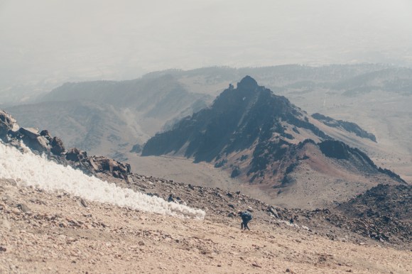
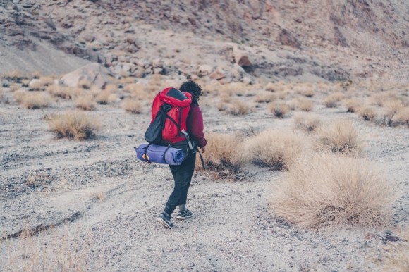
When we got back to the hut we immediately sent Adam and Anthony back down the road to get to a lower elevation. Unfortunately this meant we had to carry both of their packs down as well in addition to 7L of water each. We placed one pack on our front and one on our back and began to descend.

DSC00507.jpg
looking back on Orizaba

We made it down to another hut and stayed the night there. The next morning we walked most of the way down to town and then hitched a ride the rest of the way.

DSC00509.jpg
above the clouds
DSC00511.jpg
Matt and all the backpacks

We then all took a bus back to Mexico City. On a whim Matt and I decided to climb Iztaccihuatal as we were already acclimatized and it was near Mexico City. We took a bus for only a dollar fifty to Amecameca, and a cheap taxi to the park headquarters. By this point night had fallen. After paying the park entrance fee we found a ride with a nice man from Mexico City the last four miles to the trailhead. We camped the night there and departed very early the next morning.

DSC00526.jpg
nearing the top
DSC00561.jpg
Matt descending, Popocateptl an active volcano can be seen in the distance.

After ten hours of hiking we got back to the trailhead at around 4pm, stoked but tired. Luckily a very nice couple from Mexico City gave us a ride all the way to downtown Mexico where we stayed at a hostel. They even bought us dinner despite our insistence to buy their dinner. My karmic debt continues to grow. They said that it was on the condition that we tell Americans the Trump is wrong about Mexicans and that they are good people.

The next day(our 6th in Mexico) after walking for hours through the incredible markets in Mexico City, I took the train to the airport and flew home.

Matt’s trip report: https://www.mattymorrison.com/orizaba

Categories
Uncategorized

Death Valley VI: 40 miles in the Owlshead Mountain

After the fall semester ended I got my wisdom teeth removed and after a day or two of not doing much I was itching to head to Death Valley. Ira and I headed south in search of solitude and adventure. We spent the ride down discussing potential routes as we each had spent a lot of time researching where to go. The trip started as many other trips to Death Valley did, at Emigrant Campground.

DSC09170.jpg
Orion
DSC09196.jpg
Emigrant Campground

We decided to go to the ranger’s station at Furnace Creek to seek advice, but they told us that their guess was as good as ours. They were quite impressed with the trips we had done in Death Valley and were quite friendly but unfortunately did not give many suggestions. Thus we decided on Ira’s proposal: 50 miles in the owlshead mountains, which involved crossing an enormous barren valley to get there. Soon, we set out into the desert.

https://www.google.com/maps/d/u/0/embed?mid=1_UzWfzBI2tCzoU8mwl6aevjPpBg23dEz

It was late by the time we set out so we camped near the beautiful Ibex dunes. This was the last time we’d see another person on the whole trip.

DSC09273.jpg
Ibex dunes
DSC09266.jpg
abandoned mining structure near the ibex dunes
DSC09292.jpg
Ibex dunes at sunset

DSC09301.jpg

The next morning we set out across the Amargosa Valley, we topped off our water at Saratoga Springs but the water tasted very salty and we avoided drinking it as long as possible into the trip. There may be a better place to fill up water here but we did not find one.

DSC09336.jpg
Saratoga Springs


DSC09337.jpg
Ira crossing the enourmous Amargosa valley on the way to the Owlsheads

It took the better part of the second day but we finally made it to the Owlsheads and to the mouth of Passage Canyon.

DSC09342.jpg
the mouth of Passage Canyon, our gateway to the Owlsheads

We spent the night in Passage Canyon to hide from the wind and crested over the Owlsheads the next day. We were treated to a panoramic view and our first glimpse of Owl Lake.

DSC09352.jpg
Owl Lake from afar
DSC09360.jpg
walking across owl lake

It was very windy at Owl lake and as always is the case in the desert, water was limited so we could not linger in the Owlsheads. Soon we headed down contact canyon.

DSC09390.jpg
Ira navigating down Contact Canyon
DSC09395.jpg
Walking down Contact Canyon
DSC09614.jpg
Stars over Contact Canyon

The next day our trip came to an end, we returned to the Amargosa Valley were we walked North to the road and planned to hitch out. Eventually I would like to find a route in the Black mountains to link with this one and create a Death Valley traverse route, but for now we wanted to head back to the Bay Area to celebrate the holidays with our families.

DSC09644.jpg
Finally reaching the Mouth of Contact Canyon, the Black Mountains loom in the distance

Hitching out on the road was tougher then expected, because of the uncertainty of hitching out we carried plenty of extra food and water. Well we originally intended to go south to our car, it quickly became apparent that cars were quite sparse along the road and we could not afford to be picky, thus, we were forced to hitch North to Badwater where we knew there would be a much more favorable number of cars for hitching. 3.5 long hours later we got a ride. Never lose trust in the road.

DSC09661
Ira playing the Ukelele as we waited for a ride out

We got an impromptu tour of Death Valley after getting a ride North out of Badwater from two UC Berkeley students, who happened to be in the same hiking club as me. We saw Artist’s Drive and Zabriskie point. They then dropped us off at the junction to Dante’s view.

DSC09671.jpg
Ira hitching as the sun sets

Eventually we got two rides east which got us to Death Valley Junction. Almost every car going by was following the same formulaic tour: Badwater, to Zabriskie Point to Dante’s View for sunset and then east towards Las Vegas. They certainly had a very different experience in the valley then the one we just had and seemed noticeably less stoked about it. We were offered at least five rides to Las Vegas but turned them all down. Just as we thought our luck had run out, as it so often goes with hitching we found a ride all the way back to our car. We drove south and out of the desert. Good bye Death Valley!

As with all of my trips in Death Valley, thank you to panamintcity.com without which we would not have even considered the Owlshead Mountains.


Categories
Uncategorized

Southern Lost Coast: Usal Beach to Shelter Cove

There is not much information online about the 30 mile Southern section of the Lost Coast. It is much less crowded then the northern section but is also much more steep. It climbs sharply up a ridge and then drops just as precipitously back to the ocean. There are times when it feels like a jungle trek as the trail is very overgrown and goes straight up hills in lieu of switch backing in many places. However the persistent hiker is rewarded with stunning views and occasionally a private beach. All of this combined makes the southern section different, not better or worse then its northern cousin.

I got a group of eight students together from my school and we all set out to hike it as a key swapping trip in two days. We would each start on opposite ends, camp in the middle and exchange keys and then each hike to eachother’s car.

I mostly focused on video on this trip but I did get a few pictures worth sharing.

DSC08905
overlooking Usal Beach


DSC08938
One of many beaches along the trail


DSC08914
classic rugged lost coast


DSC08968
Enter a caption

DSC08946

DSC08966
Roosevelt Elk
DSC08985
Emily walking on the trail north of Needle point


DSC08996
One of the last glimpses of the Lost Coast

Video below:

Categories
Uncategorized

The High Sierra Trail in three days

In keeping with the tradition of doing a crazy trip over Veteran’s day weekend. Matt and I set our sights on the 72 mile High Sierra Trail. This trail is typically done in one to two weeks, but we figured that by hiking light and fast we could do it in three days. Furthermore the cold scared most people away so we had the trail to ourselves, we did not see a single person past Trail Crest. No pre reserved permits were needed.

However, we had to hope that winter would not come early and blanket the trail in snow, as this would certainly foil our trip. The weeks ticked on and winter still did not begin in the Sierras, so the trip was a go, we invited our friends Adam and Jared who we had done a lot of trips with and Sim and Ng too motivated hikers from our school who would go in the opposite direction and key swap with us.

Unfortunately we did not leave Berkeley until 8pm due to numerous delays. This meant that when we got to the trailhead we decided that instead of sleeping for a few hours it would be best to start right away. This however was a mistake as none of us got more then an hour of sleep on the car ride there.

At first the hike went very well, we were all stoked to get out there and finally start the trail, we pounded out some miles and before we knew it we were at trail camp and the sun was rising.

DSC07198.jpg
sunrise from trail camp

As we climbed the switchbacks we got more and more tired and we began to feel the altitude. By the time we got to trailcrest I was ready to fall asleep.

DSC07213.jpg
View westward from trail camp, the next two days of our route neatly laid out before us

Despite my exhaustion I wanted to go on to the summit. Luckily Matt convinced me that it would be better to get some rest as my exhaustion was only exacerbated by the lack of oxygen and continuing higher would be potentially dangerous. In the moment I really wanted to get to the top of Mt Whitney, but I am glad I rested up instead. I probably could have made it to the summit, but I came here for the High Sierra Trail, not for Mt Whitney which I had already climbed. CLimbing Mt. Whitney would have jeopardized the rest of the trip for me.

So I walked down the trail west of trail crest and found a small bivy spot to take a nap. Two hours later my friends came and woke me up and I was feeling much better. We continued down towards Guitar Lake.

DSC07216.jpg
beautiful lakes on the west side of Whitney
DSC07217.jpg
Matt taking a well deserved break

We descended to Crabtree meadow and camped the night there, it was in the single digits that night but we were all exhausted so we slept soundly. The next morning we set off westward into the Kern River headwaters and the heart of the Southern Sierra.

DSC07230.jpg
Looking ahead towards the Monarch Divide

The miles began to fly by, this was the flattest part of the trail and we no longer were completely sleep deprived like on the first day. We had lunch at the Kern Hot Springs, which were rather underwhelming at this time of year, and we continued west. At around 4pm we were relieved to run into Sim and Ng, they were right on pace as they had an extra day to complete the trail, we screamed for joy and hugged them before exchanging tips on the trail ahead.

But we were all over 30 miles from a road, the draw of getting back to school pulled us back to civilization and the impending winter made us not get too comfortable in the mountains. We are fairly certain that we were the last people to complete the High Sierra Trail in 2017 as a storm came later that week. The snow free trail that we enjoyed soon became buried deep in snow for the next six plus months. All in all se hiked 28 miles that day and made it a few miles short of Kaweah gap.

DSC07268.jpg
The trail ahead the next morning

We walked across dead meadows and eventually attained Kaweah gap. We were treated to spectacular view in both directions and took some time to soak it all in.

DSC07274.jpg
view east from Kaweah Gap
DSC07303.jpg
west from the gap
DSC07326.jpg
descending towards precipice lake
DSC07335.jpg
first glimpse of precipice lake
DSC07345.jpg
Matt overlooking the frozen Precipice Lake
DSC07390.jpg
Frozen Precipice lake
DSC07425.jpg
Hamilton Lake

DSC07470.jpg

DSC07429.jpg

DSC07466.jpg

DSC07484.jpg

As we descended further and further away from Kaweah gap we slowly left the alpine wonderland and entered the forest. We walked and walked and the miles began to drag on, it got dark and finally we reached the car around 6:30. We did it we completed the High Sierra Trail in three days!

DSC07493.jpg
the sweet taste of victory

Matt’s trip report: https://www.mattymorrison.com/hst-2018

Short video of the trip below:

Categories
Uncategorized

Mineral King loop

I’d always wanted to go to Mineral King and it is one of the easier places in the Sierra to get permits to, so one weekend in September. Adam, Evan, Will and I set out to do a trip there. It is a beautiful part of the Sierra and if you can get over driving on Mineral King’s infamous 498 curve entrance road then it is a perfect place for a last minute trip. We did an about 30 mile loop visiting Little 5 Lakes basin, Big 5 Lakes basin and Columbine Lake, I also climbed Sawtooth Peak.

DSC05003.jpg
lunch break
DSC05021.jpg
Indian Paintbrush:one of the last few remaining wildflowers
DSC05035.jpg
Entering Little 5 Lakes Basin
DSC05571.jpg
Nearing Columbine Lake
DSC05616.jpg
Columbine Lake
DSC05628.jpg
Sawtooth Peak looming overColumbine Lake

After Columbine Lake I split with my friends and climbed Sawtooth Peak alone. While it looks difficult from afar, it got much easier up close, as sierra peaks tend to do. The views from the top were fantastic, but clouds were moving in so the view was partially obstructed.

DSC05688.jpg
Columbine Lake from Sawtooth Peak


I then ran down the trail to catch up with my friends before they got to the car. Infinity switchbacks later and then infinity curves later and we were back in the Central Valley heading back to school.