My friend Arman drops me off on the side of highway one on the California Coast and we say our goodbyes. This is actually happening. Months of homework, tests to study for and dreaming about heading north and now here I am nothing separating me from the biggest adventure of my life. His car rolls away, I put my pack down and stick out my thumb.
The going was slow the first day. My mind went through the familiar ups and downs of hitchhiking. After hours of waiting on the side of the road, cautious optimism that I will get picked up soon turns into pessimism and I lose my faith that anyone will ever pick me up. Suddenly I get a ride and my faith in humanity is restored. Unforunately many of the rides I got were quite short. I would wait for hours to only go 15 miles up the road. Finally after waiting for hours for a ride just South of the Lost Coast, I got a ride all the way to Humboldt.
It was my first night on the road though and I wasn’t smart, they dropped my off at a campsite that cost 45$. Of course this was a ridiculous scam and I did not pay it. Instead I walked 6 miles into downtown Humboldt. No one wanted to pick me up as it was well past dark. There was a large homeless population in the town and people mistook me for them and gave me a wide breadth as I passed. After many failed attempts at hitching on the on ramp, I broke down and paid 10 bucks for an Uber to a campground by the beach. This ended up being the right decision, I met some cool people sitting around a campfire and slept in the sand dunes that night.
The second day started out slowly as well, but I was standing on the beautiful California Coast so it didn’t really matter. A few rides later and I got a ride into Oregon and almost halfway up it. This guy and I talked about our whole lives and lots of different political issues for four hours, but I didn’t even get his name. I swore not to repeat my mistake of the previous night and stopped hitching well before dark. I got a great campspot on the Oregon Coast and it was only 6$ (this was one of only two times I had to pay for camping on this whole trip)
I headed north and the Coast only got prettier. That evening I found myself in Astoria, on the Oregon Washington Border. On a whim I threw my thumbout in the middle of a busy intersection with no good place to stop. It had just started to rain and the chances of getting a ride looked bleak, but suddenly a women stopped in the middle of the intersection blocking all of the traffic and motioned for me to get in quickly. Suddenly we were cruising along at 60mph and crossing over the Columbia River and into Washington on the Astoria Bridge.
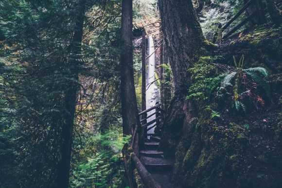
I camped outside of her RV that night and had the goal of getting to Sequim Washington that day. It was slow going but I linked a few rides together and made it to Forks Washington just outside of Olympic National Park. From there I took a bus into the park and went for a short hike to see a waterfall.
I took another bus to Sequim to stay at a friend from school’s house. I met her through the hiking club and it was very nice of her to put me up for the night and let me shower. I was atempting to cross an international border the next day so showering was essential.
The next morning I boarded the ferry across the San Juan de Fuca straight and into Canada. I had done some reasearch and it seemed that I was most likely to get into Canada by ferry and if I hitched in at a land crossing I may get denied entry. Unfortunately it was the middle of the week and the other people on the ferry were mostly retired. With my large pack, I stood out like a sore thumb.
A 90 minute boatride later and I was in Canada. I nervously awaited my turn at customs and when it came I tried to be as vague as possible in my responses to questions. I knew this was a turning point in my trip, if I got rejected, I’d have to head home. The customs women was less then thrilled with my vague answers and pressed me for specifics I did not have. What hotel was I staying at? How did I hear about BC? Where was I going to see? on and on and on. Of course I could not tell her that I would be sleeping on the side of the road and planned to hitch to Alaska, so I told her I wanted to see Vancouver. Finally after I told her I had a job to go back to in the states in June, and school in August she reluctantly waived me through.
Canada was very different from the United States which I did not expect. I expected Victoria to be a small town but it felt like a big city. My phone no longer had reception and the money was different. But most importantly the people were much more willing to pick up hitchhikers. I took a bus and a ferry to get to mainland Canada and I got 5 rides after 4pm through Squamish Pemberton and Whistler. One time I got a ride 4 seconds after sticking my thumb out. While I was starting to grow tired of the emotional roller coaster that hitchhiking was in the United States, I now felt a lot better about my chances of making it to Alaska. When people asked where I was going instead of cautiously telling them I was going as far north as I could get I began to boldly declare Alaska.
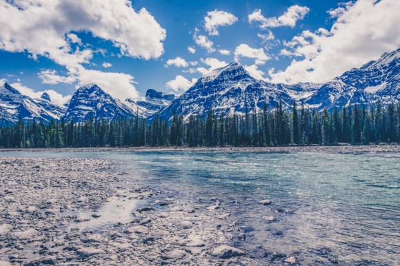
I took a detour to go to Banff and Jasper instead of blazing through central British Columbia. It was a bit difficult to get a ride out of Kamloomps but finally an eccentric older gentleman picked me up. He had a different women in every town and he stopped frequently to offer to buy things that were not for sale from people’s homes. But a ride is a ride and I did not complain. As soon as I neared the National Parks the rides began to come very quickly. I made the mistake of getting let out in Lake Louise where the rangers told me if I camped I would get eaten by a Grizzly bear. Not sure what to believe I caught a ride down to the town of Banff at the last light. I got picked up by a family as I was walking around the town, even though my thumb was not out. The man was very loud and a bit drunk and told me that his seven year old had just been driving the car. I was a bit apprehensive about getting in the car with him but he offered me a free place to tent at their camp spot so I took it. Upon returning to his camp spot his girlfriend was less then thrilled that he had picked up a hitchhiker with her two and seven year olds in the car, but she quickly warmed up to me. He on other hand did not get along with her and they always seemed to be at odds which created a very uncomfortable dynamic. He broke all of the rules in the campground including having hard alcohol, playing loud music at night and leaving food out at night. When the ranger informed him of this he replied that he would shoot any bear that tried to get his food. His girlfriend and the ranger were not happy and she quickly apologized on his behalf.
They kindly gave me a ride the next morning though and I was back on the road in one of the most beautiful places on earth.

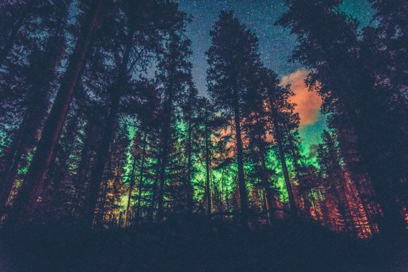
That night a very friendly Canadian couple picked me up along with four other hitchhikers. They let us camp in their campspot next to their RV and even cooked us a fantastic meal. We stayed up while into the night talking. It didn’t get fully dark until midnight but when it did we were treated to a glimpse of the northern lights.
I would have liked to stay in Jasper longer but my sights were set on Alaska so I got back on the road. After a quick hitch out of the park and past Mt. Robson, I was again stuck on the side of the road for four hours. A cop came by and I thought she was going to give me a hard time, but after 15 minutes of running my documents she drove off. Luckily I soon got the longest ride of my trip so far from Hank a very interesting gentleman who was heading out to the middle of nowhere in Northern BC where he was attempting to build a settlement and move his family there to live off the land. His sister generously let me stay in her backyard for the night and the next morning he dropped me off at the base of the Stewart-Cassiar Highway in Kitwanga BC. It turned out to be a good thing he gave me a ride through this section as the Prince George to Prince Rubert stretch of highway is notrious for being a dangerous highway to hitch on, dubbed the “highway of tears”. Many signs were put up to discourage hitchhiking.
A tow truck driver gave me a ride an hour up the highway to Meziadin Junction. This to me was another key turning point of the trip. I stood on the empty road for a while and only about one car was going north every hour, the prospects seemed grim. I mentally readied myself to wait a few days on the side of the road and potentially having to turn around after having come so far. The one bright side though was that it was a 16 hour drive up to Whitehorse and there were only a few small towns in between. If I got a ride it would be a long one. Luckily a gentleman named Billy picked me up and we he drove me for 2.5 days.
Billy had been driving for over 20,000 km and had been on the road for months, visiting most of the western United States. After two and a half good days on the road with good company and not worrying about getting a ride, Billy dropped me off in Whitehorse. Luckily not more then an hour later a gentleman named Andy picked me up and he said he would take me all the way to Alaska.

Andy worked seasonally in Alaska and drove up there in his vegetable oil powered car every summer. He told me a lot about places to visit, since I didn’t know if I would even make it this far, I didn’t do much research on Alaska itself.

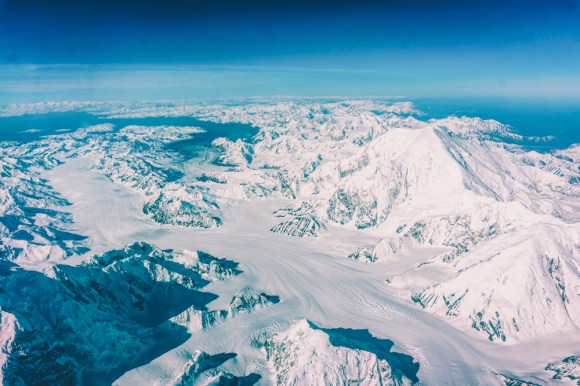
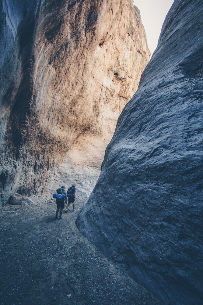
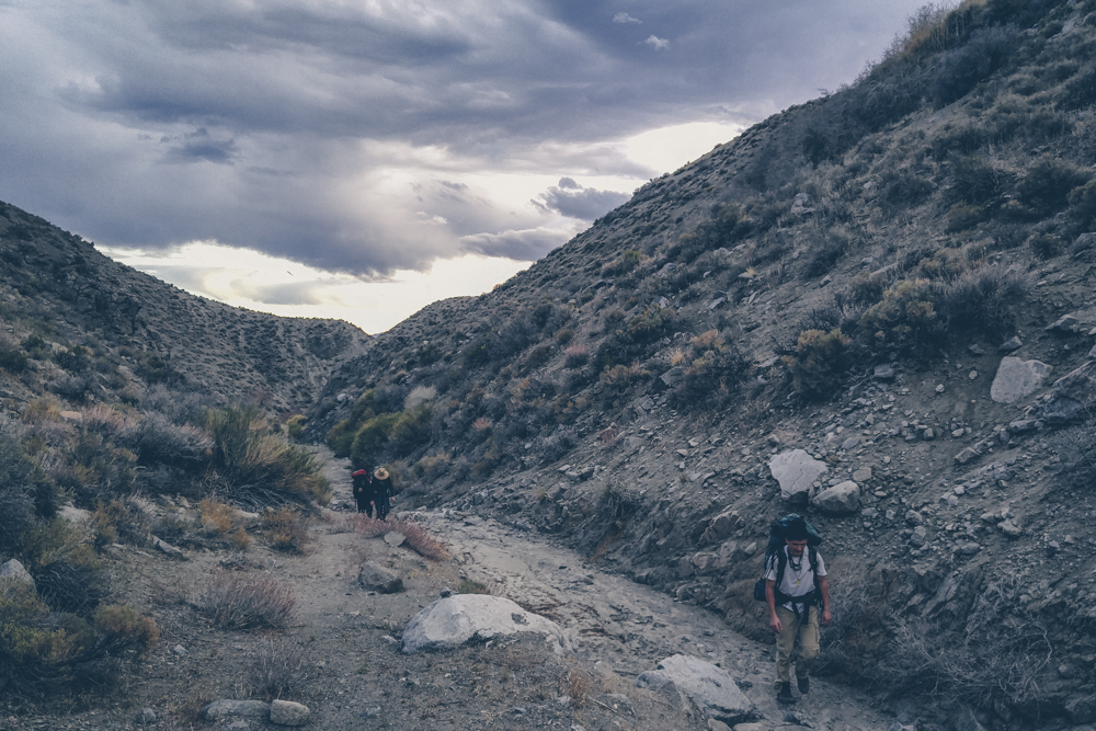
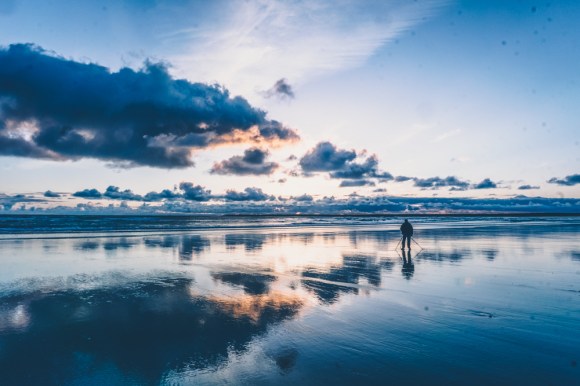
Andy dropped me off on the Kenai Penninsula and after hitching around there for a while and seeing the glaciers and going backpacking on the coast I headed north. I stayed at a hostel in Anchorage to charge my batteries and rest. It is never really dark in Alaska so it was good to sleep in the dark for one night. I hitched up to Denali National Park. After 55 rides I became less eager to tell my story and hear the story of every person who gave me a ride and more comfortable sitting in silence.
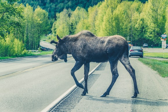
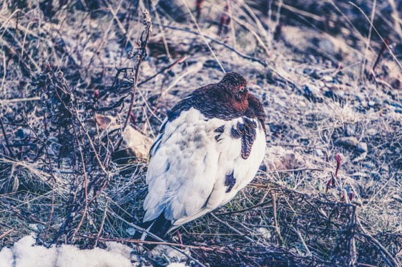
The next morning I headed into Denali National Park on the mandatory bus. It was beautiful and we saw lots of wildlife.
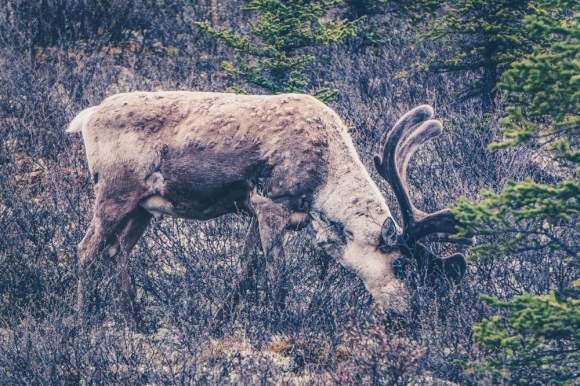
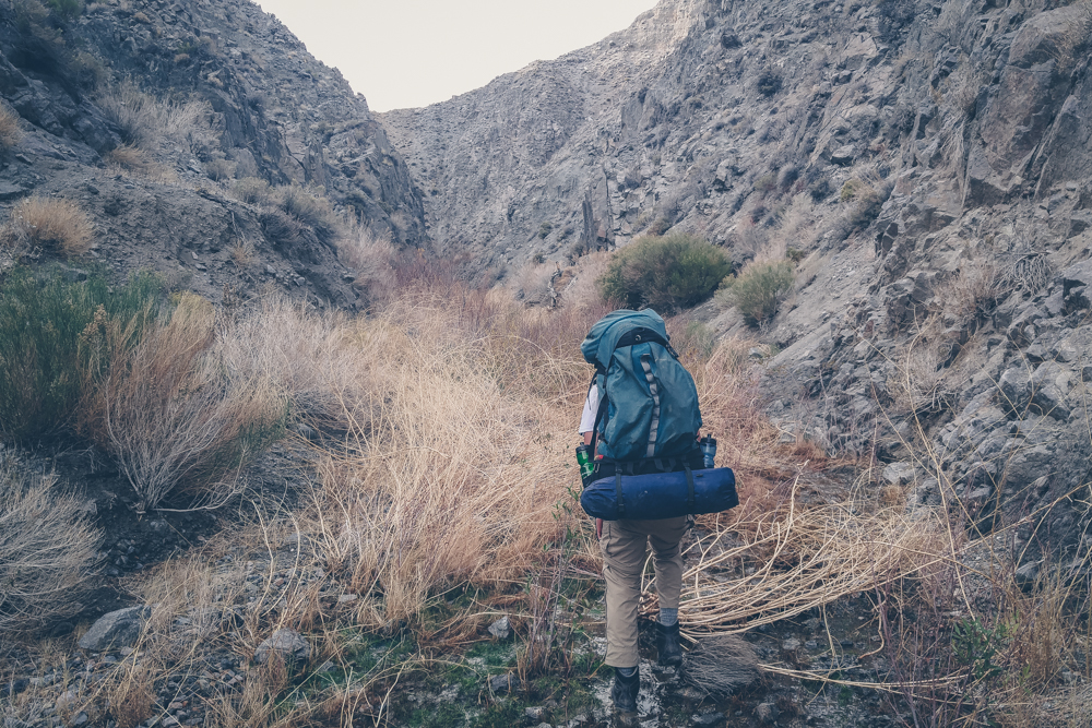
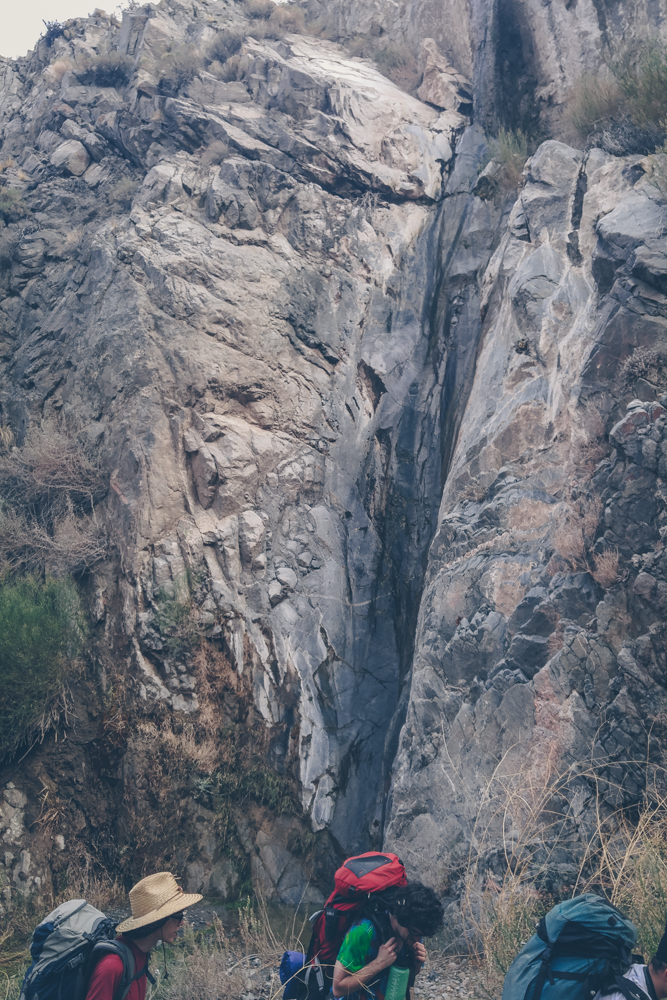
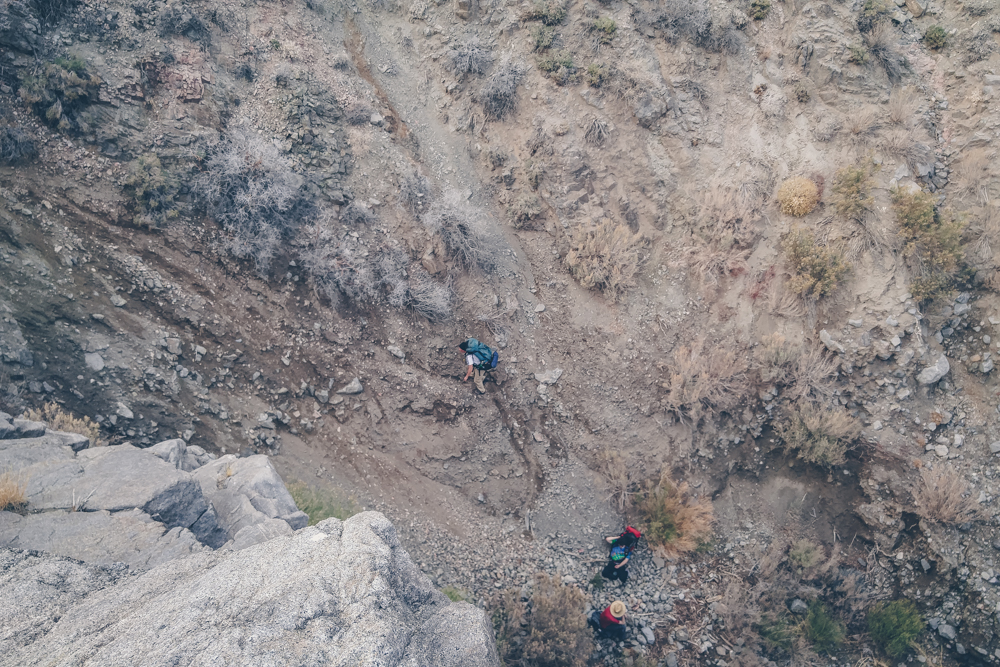
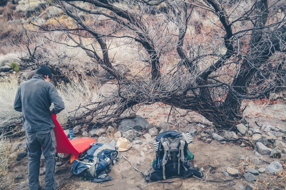
As the bus returned back to the main road, I got off at the Teklanika River and headed north into the Alaskan wilderness. There are almost no trails in Denali National Park and I did not see anyone for the next 3 days. I had a rough plan of heading north from the road and trying to get to the Magic Bus completely off trail. Off trail travel was hard in Denali and my feet were constantly wet. It was beautiful however, and I walked across a big mountain range and had sweeping views of the park. My legs got very scratched up but a day and a half later I reached the bus.

I decided returning off trail would be far too difficult so I elected to take the less beautiful Stampede trail which is mostly in the trees. It was much quicker then off-trail and that night I crossed the mighty Teklanika river, which luckily was not very high.

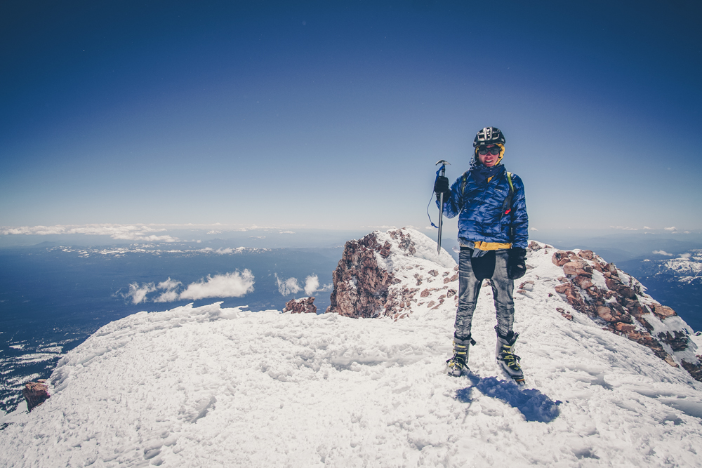
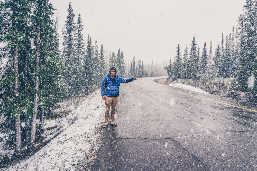
I got a little lost the next day and went the wrong way for a few hours, discouraged, I finally got back to where I started around 3pm. At this point my body was falling apart and it hurt to walk. I had huge blisters on both feet and I had no idea how to take care of them. Nevertheless I walked out and just before I reached the road I ran into an Australian guy who was trying to get to the bus. Since he had no food or shelter I told him to turn around, and luckily he agreed, we walked out together and he gave me a ride into Healy. James had been travelling around the US trying to see the most touristy things possible including, 8 mile, Walter White’s house and he even appeared on the People’s court. His last planned stop was the bus but it did not pan out. He then drove me to Denali to return my bearcan and took this very staged picture of me hitchhiking in the snow.

The park was closed due to snow so he drove me back to Fairbanks. James was my 55th and final ride of the trip. I tried to get a ride up to Prudhoe Bay but I was unsuccesful. This truck driver offered me a ride on Craigslist but he never showed up at the Walmart we planned to meet at. I camped the night there and then went to the Fairbanks airport the next day.
There is so much to see in Alaska and I barely scratched the surface. I really want to move there one day!